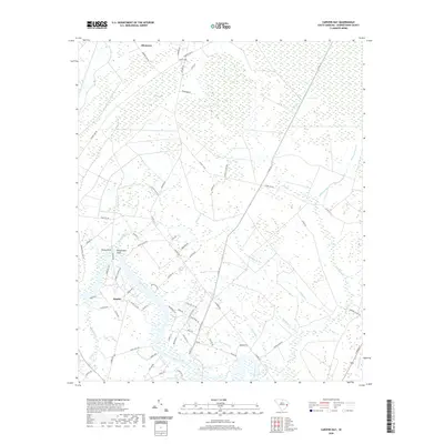
2020 Map of Carvers Bay
USGS Topo · Published 2020About this map
The Black River dominates the southwestern portion of this Georgetown County landscape, where tidal influences and wetland ecosystems meet established settlements. The community of Dunbar sits near the riverbanks, joined by nearby Rocky Point and Belleflower Point as historical landing spots or points of interest along the water. Further inland, the terrain is characterized by the distinctive oval depressions of Carolina bays, most notably Carvers Bay and Machine Bay. These geological features, often filled with dense vegetation, create a unique drainage pattern seen in the many small tributaries like Choppee Creek and Post Foot Br. The map also reveals a network of local roads such as Choppee Rd and Bombing Range Rd, connecting the northern hamlet of Allentown to the river corridor, illustrating how the region's geography dictated its transportation and settlement patterns.
Find a feature on this map
83 named features on this map. Tap any name to fly to it.
Don’t see what you’re looking for? This feature index may not catch every label — zoom into the map to look around manually.
Map Details
Editions of this 2020 Carvers Bay Map
This is the sole edition of this map. No revisions or reprints were ever made.
Other maps of this area

1942 · Waverly Mills
USGS Topo · 1:24,000

1943 · Olin
USGS Topo · 1:31,680

1943 · Yauhannah
USGS Topo · 1:24,000

1943 · Henry
USGS Topo · 1:24,000

1943 · Carvers Bay
USGS Topo · 1:24,000

1943 · Plantersville
USGS Topo · 1:24,000

1943 · Rhems
USGS Topo · 1:24,000

1943 · Georgetown North
USGS Topo · 1:24,000

1943 · Outland
USGS Topo · 1:24,000

1944 · Outland
USGS Topo · 1:31,680