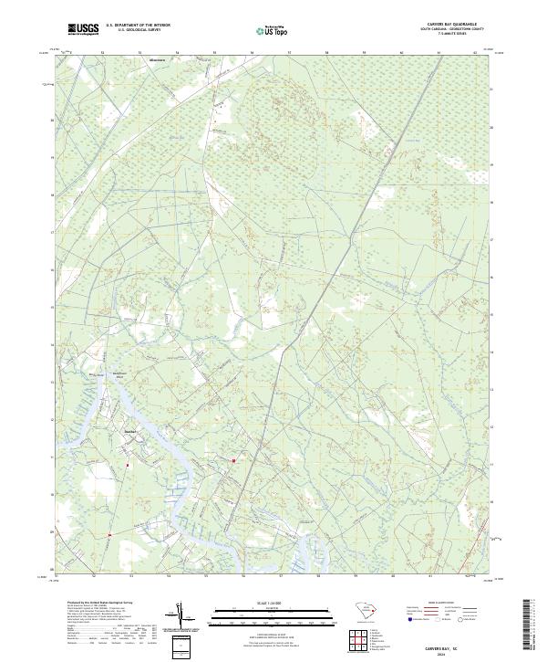
2024 Map of Carvers Bay
USGS Topo · Published 2024About this map
The Black River defines the southern reach of this Georgetown County landscape, where the river's winding course creates a complex network of wetlands and tributaries. Small settlements like Dunbar and Allentown are linked by a grid of rural roads, including Carvers Bay Rd and Choppee Rd, which navigate the low-lying terrain. The map highlights distinctive geological formations known as Carolina Bays, notably Carvers Bay and Machine Bay, which appear as elliptical depressions amidst the forest and swamp.
Find a feature on this map
79 named features on this map. Tap any name to fly to it.
Don’t see what you’re looking for? This feature index may not catch every label — zoom into the map to look around manually.
Map Details
Editions of this 2024 Carvers Bay Map
This is the sole edition of this map. No revisions or reprints were ever made.
Other maps of this area

1942 · Waverly Mills
USGS Topo · 1:24,000

1943 · Olin
USGS Topo · 1:31,680

1943 · Yauhannah
USGS Topo · 1:24,000

1943 · Henry
USGS Topo · 1:24,000

1943 · Carvers Bay
USGS Topo · 1:24,000

1943 · Plantersville
USGS Topo · 1:24,000

1943 · Rhems
USGS Topo · 1:24,000

1943 · Georgetown North
USGS Topo · 1:24,000

1943 · Outland
USGS Topo · 1:24,000

1944 · Outland
USGS Topo · 1:31,680