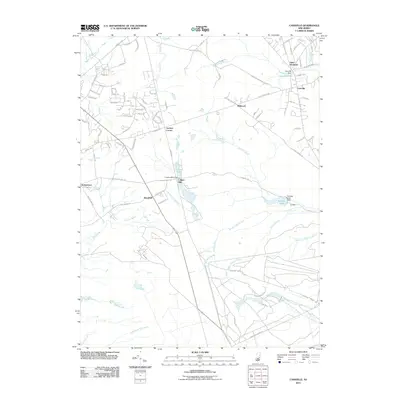
2011 Map of Cassville
USGS Topo · Published 2011About this map
Cassville and its surrounding hamlets occupy this section of the Pine Barrens at a time of residential growth along its historical rural road network. The landscape is defined by the headwaters of the Toms River and numerous stream branches, many of which are impounded by structures such as the Cassville Dam, Colliers Mills Dam, and Success Lake Dam. These reservoirs, including Colliers Lake and Success Lake, reflect a long history of water management for milling and local industry in the region.
Find a feature on this map
100 named features on this map. Tap any name to fly to it.
Don’t see what you’re looking for? This feature index may not catch every label — zoom into the map to look around manually.
Map Details
Editions of this 2011 Cassville Map
This is the sole edition of this map. No revisions or reprints were ever made.
Other maps of this area

1884 · Whitings
USGS Topo · 1:62,500

1888 · Bordentown
USGS Topo · 1:62,500

1888 · Pemberton
USGS Topo · 1:62,500

1888 · Cassville
USGS Topo · 1:62,500

1888 · Whitings
USGS Topo · 1:62,500

1893 · Bordentown
USGS Topo · 1:62,500

1894 · Cassville
USGS Topo · 1:62,500

1894 · Pemberton
USGS Topo · 1:62,500

1898 · Pemberton
USGS Topo · 1:62,500

1900 · Cassville
USGS Topo · 1:62,500
Featured Places
- Jackson Township, NJ
- Manchester Township, NJ
- Plumsted Township, NJ
- Upper Freehold Township, NJ
- Colliers Mills, Jackson Township