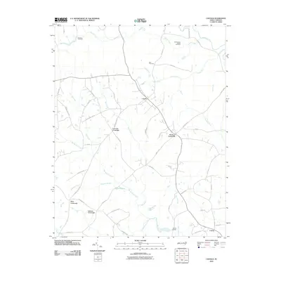
2010 Map of Castalia
USGS Topo · Published 2010About this map
Castalia and its surrounding rural hamlets form the center of this Nash County landscape, where the geography is defined by a dense network of slow-moving waterways and swampy drainages. The pattern of settlement is clearly tied to the higher ground between these basins, with nodes like Lancaster Crossroads, Matthews Crossroads, and Mays Crossroads marking the intersections of local commerce and community. In the southern reach of the quadrangle, the presence of Boddies Millpond and the Boddie Bridge over Stony Creek suggests a history of local water-driven industry and longtime family landholdings. Extensive natural features such as Back Swamp, Big Peachtree Creek, and Tumbling Run dominate the terrain, illustrating the persistent challenge of navigating and farming the low-lying wetlands that characterize this portion of the coastal plain. Small-scale place names like Corinth and Edwards Crossroads provide specific touchpoints for researchers tracing early twenty-first-century property lines and community development.
Find a feature on this map
52 named features on this map. Tap any name to fly to it.
Don’t see what you’re looking for? This feature index may not catch every label — zoom into the map to look around manually.
Map Details
Editions of this 2010 Castalia Map
This is the sole edition of this map. No revisions or reprints were ever made.
Other maps of this area

1902 · Rocky Mount
USGS Topo · 1:62,500

1902 · Spring Hope
USGS Topo · 1:62,500

1904 · Rocky Mount
USGS Topo · 1:62,500

1904 · Springhope
USGS Topo · 1:62,500

1953 · Norfolk
USGS Topo · 1:250,000

1953 · Rocky Mount
USGS Topo · 1:250,000

1953 · Raleigh
USGS Topo · 1:250,000

1953 · Greensboro
USGS Topo · 1:250,000

1954 · Greensboro
USGS Topo · 1:250,000

1954 · Rocky Mount
USGS Topo · 1:250,000