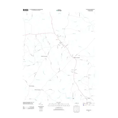
2013 Map of Castalia
USGS Topo · Published 2013About this map
Castalia serves as the focal point of this northern Nash County landscape, where a grid of streets like Church St and Harrison St gives way to a network of rural crossroads. The area's geography is defined by a dense system of waterways and historic impoundments, including the Bodies Millpond and Boddies Millpond. These water features, alongside Back Swamp and Big Peachtree Cr, illustrate the drainage patterns that have historically shaped local property lines and agricultural boundaries. Evidence of long-standing family landholdings and rural commerce is visible in the numerous named junctions such as Lancaster Crossroads, Matthews Crossroads, and Edwards Crossroads. The presence of Boddie Bridge and roads like Layton Store Rd and Lancaster Store Rd suggest a landscape rooted in a mercantile and mill-based economy that once connected these dispersed farming communities.
Find a feature on this map
87 named features on this map. Tap any name to fly to it.
Don’t see what you’re looking for? This feature index may not catch every label — zoom into the map to look around manually.
Map Details
Editions of this 2013 Castalia Map
This is the sole edition of this map. No revisions or reprints were ever made.
Other maps of this area

1902 · Rocky Mount
USGS Topo · 1:62,500

1902 · Spring Hope
USGS Topo · 1:62,500

1904 · Rocky Mount
USGS Topo · 1:62,500

1904 · Springhope
USGS Topo · 1:62,500

1953 · Norfolk
USGS Topo · 1:250,000

1953 · Rocky Mount
USGS Topo · 1:250,000

1953 · Raleigh
USGS Topo · 1:250,000

1953 · Greensboro
USGS Topo · 1:250,000

1954 · Greensboro
USGS Topo · 1:250,000

1954 · Rocky Mount
USGS Topo · 1:250,000