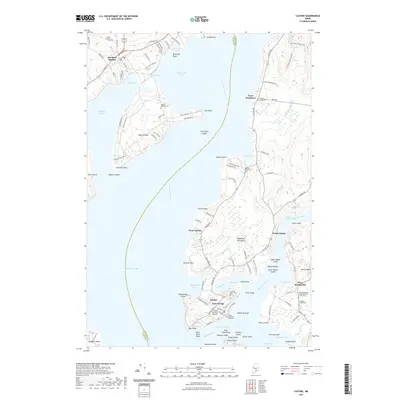
2021 Map of Castine
USGS Topo · Published 2021About this map
Castine stands as a prominent maritime hub on this coastal survey, where the Bagaduce River meets Penobscot Bay. The town's historical geography is deeply etched into the landscape, featuring the notable Fort George and the British Canal near Wadsworth Cove. As a center for maritime education and history, the area includes the Maine Maritime Academy campus and several historic burial grounds, such as the Castine Town Cem.
Find a feature on this map
128 named features on this map. Tap any name to fly to it.
Don’t see what you’re looking for? This feature index may not catch every label — zoom into the map to look around manually.
Map Details
Editions of this 2021 Castine Map
This is the sole edition of this map. No revisions or reprints were ever made.
Other maps of this area

1900 · Orland
USGS Topo · 1:62,500

1900 · Bucksport
USGS Topo · 1:62,500

1902 · Bucksport
USGS Topo · 1:62,500

1902 · Castine
USGS Topo · 1:62,500

1904 · Castine
USGS Topo · 1:62,500

1904 · Bluehill
USGS Topo · 1:62,500

1905 · Penobscot Bay
USGS Topo · 1:125,000

1941 · Castine
USGS Topo · 1:62,500

1942 · Orland
USGS Topo · 1:62,500

1942 · Bucksport
USGS Topo · 1:62,500