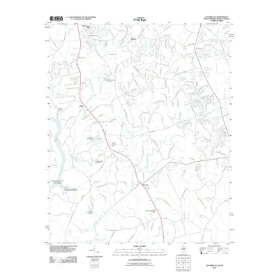
2011 Map of Catawba NE
USGS Topo · Published 2011About this map
Marvin and Belair anchor this landscape along the border of the Carolinas, where the terrain is defined by a dense network of waterways feeding into the Catawba River. The map reveals a suburbanizing countryside at the start of the 2010s, yet it retains deep connections to its past through sites like the Pleasant Valley Cemetery and Six Mile Cemetery. The local drainage pattern is particularly intricate, featuring numerous engineered water bodies such as Bowers Pond and various ponds managed by Nesbit Farms Incorporated.
Find a feature on this map
146 named features on this map. Tap any name to fly to it.
Don’t see what you’re looking for? This feature index may not catch every label — zoom into the map to look around manually.
Map Details
Editions of this 2011 Catawba NE Map
This is the sole edition of this map. No revisions or reprints were ever made.
Other maps of this area

1905 · Charlotte
USGS Topo · 1:48,000

1907 · Charlotte
USGS Topo · 1:62,500

1941 · Charlotte
USGS Topo · 1:125,000

1941 · Spartanburg
USGS Topo · 1:250,000

1942 · Charlotte
USGS Topo · 1:125,000

1953 · Spartanburg
USGS Topo · 1:250,000

1953 · Charlotte
USGS Topo · 1:250,000

1954 · Charlotte
USGS Topo · 1:250,000

1960 · Charlotte
USGS Topo · 1:250,000

1960 · Spartanburg
USGS Topo · 1:250,000