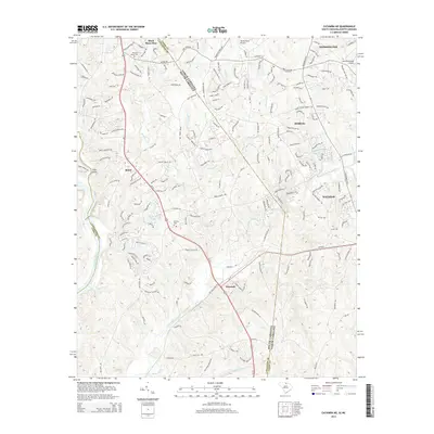
2014 Map of Catawba NE
USGS Topo · Published 2014About this map
Sixmile Cr and Twelvemile Creek weave through the borderlands of North and South Carolina in this detailed survey. The landscape is defined by the rapid suburban growth along the Us-521 corridor, connecting settlements like Weddington, Marvin, and Waxhaw. Despite the increasing network of residential roads like Thousand Oaks Rd and Dogwood Acres Rd, historical markers of the area's rural past remain visible.
Find a feature on this map
168 named features on this map. Tap any name to fly to it.
Don’t see what you’re looking for? This feature index may not catch every label — zoom into the map to look around manually.
Map Details
Editions of this 2014 Catawba NE Map
This is the sole edition of this map. No revisions or reprints were ever made.
Other maps of this area

1905 · Charlotte
USGS Topo · 1:48,000

1907 · Charlotte
USGS Topo · 1:62,500

1941 · Charlotte
USGS Topo · 1:125,000

1941 · Spartanburg
USGS Topo · 1:250,000

1942 · Charlotte
USGS Topo · 1:125,000

1953 · Spartanburg
USGS Topo · 1:250,000

1953 · Charlotte
USGS Topo · 1:250,000

1954 · Charlotte
USGS Topo · 1:250,000

1960 · Charlotte
USGS Topo · 1:250,000

1960 · Spartanburg
USGS Topo · 1:250,000