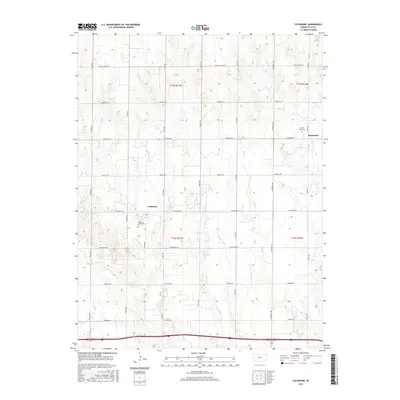
2015 Map of Catharine
USGS Topo · Published 2015About this map
Catharine and the nearby settlement of Emmeram anchor this portion of the Kansas plains, where the grid of sections is deeply etched into the rural landscape. This modern survey shows a region defined by agricultural infrastructure and long-standing community centers. Local heritage is preserved at the Saint Catharina Cem and the Sacred Heart Cem, which serve as quiet landmarks for the area's genealogical history. The terrain is marked by the drainages of N Fork Big Cr, Walker Cr, and Mud Cr, which cut through the high ground. A network of local routes like Fairground Rd and Airbase Rd connects the scattered homesteads and feedlots, reflecting a modern agrarian economy built upon a historical framework of townships and ranges.
Find a feature on this map
26 named features on this map. Tap any name to fly to it.
Don’t see what you’re looking for? This feature index may not catch every label — zoom into the map to look around manually.
Map Details
Editions of this 2015 Catharine Map
This is the sole edition of this map. No revisions or reprints were ever made.
Other maps of this area

1896 · Hays
USGS Topo · 1:125,000

1896 · Plainville
USGS Topo · 1:125,000

1955 · Great Bend
USGS Topo · 1:250,000

1955 · Beloit
USGS Topo · 1:250,000

1957 · Great Bend
USGS Topo · 1:250,000

1958 · Great Bend
USGS Topo · 1:250,000

1959 · Beloit
USGS Topo · 1:250,000

1961 · Hays South
USGS Topo · 1:24,000

1961 · Catharine
USGS Topo · 1:24,000
1961 · Hays North
USGS Topo · 1:24,000