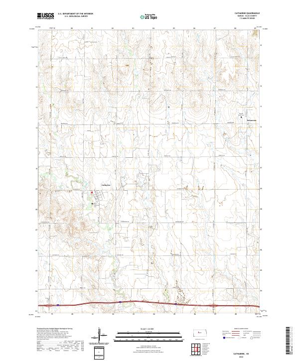
2022 Map of Catharine
USGS Topo · Published 2022About this map
Catharine and Emmeram anchor this section of the High Plains, where the grid of county roads defines a landscape deeply tied to German-Russian heritage. The settlement at Catharine is characterized by its organized street names like St John St and Saint Catharina St, pointing to the Catholic roots of the Volga German immigrants who settled the area. These cultural markers extend to local resting places such as Saint Catharina Cem and the Sacred Heart Cem near Emmeram, which provide vital touchstones for genealogists tracing early families in the region. The terrain is carved by the drainages of Walker Cr, Mud Cr, and the N Fork Big Cr, which create the only breaks in the geometric agricultural divisions. This survey captures the enduring rural character of Ellis County, where named routes like Feedlot Rd and Fairground Rd reflect the agricultural and communal focus of the modern era.
Find a feature on this map
30 named features on this map. Tap any name to fly to it.
Don’t see what you’re looking for? This feature index may not catch every label — zoom into the map to look around manually.
Map Details
Editions of this 2022 Catharine Map
This is the sole edition of this map. No revisions or reprints were ever made.
Other maps of this area

1896 · Hays
USGS Topo · 1:125,000

1896 · Plainville
USGS Topo · 1:125,000

1955 · Great Bend
USGS Topo · 1:250,000

1955 · Beloit
USGS Topo · 1:250,000

1957 · Great Bend
USGS Topo · 1:250,000

1958 · Great Bend
USGS Topo · 1:250,000

1959 · Beloit
USGS Topo · 1:250,000

1961 · Hays South
USGS Topo · 1:24,000

1961 · Catharine
USGS Topo · 1:24,000
1961 · Hays North
USGS Topo · 1:24,000