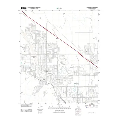
2012 Map of Cathedral City
USGS Topo · Published 2012About this map
Cathedral City is the central hub of this 2012 survey, situated in a landscape defined by desert washes and the developing recreational infrastructure of the Coachella Valley. The Whitewater River and Palm Canyon Wash carve through the arid terrain, which is bracketed by Flat Top Mountain to the north and Murray Hill to the south. Notable local settlements and residential developments include Royal Palms, Caliente Sands, and Suntown, alongside agricultural and commercial features like the Snyder Date Gardens and Ferguson Ranch. The area's focus on leisure is evident in the dense concentration of golf courses such as the Mission Hills North Golf Course and Dinah Shore Golf Course. Transportation follows the path of the Banning Indio Rd, which connects the larger city with smaller outlying points like Rimlon and Edom. For genealogists and local historians, the Palm Springs District Cem provides a specific point of interest within this suburbanizing desert environment.
Find a feature on this map
124 named features on this map. Tap any name to fly to it.
Don’t see what you’re looking for? This feature index may not catch every label — zoom into the map to look around manually.
Map Details
Editions of this 2012 Cathedral City Map
This is the sole edition of this map. No revisions or reprints were ever made.
Other maps of this area

1901 · Southern California Sheet No. 1
USGS Topo · 1:250,000

1901 · San Jacinto
USGS Topo · 1:125,000

1904 · Indio
USGS Topo · 1:125,000

1904 · Southern California Sheet No. 1
USGS Topo · 1:250,000

1940 · Palm Springs
USGS Topo · 1:62,500

1940 · Hemet Reservoir
USGS Topo · 1:62,500

1941 · Toro Peak
USGS Topo · 1:62,500

1941 · Edom
USGS Topo · 1:62,500

1942 · Hemet Reservoir
USGS Topo · 1:62,500

1944 · Toro peak
USGS Topo · 1:62,500