
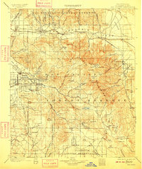
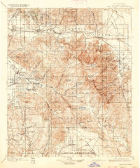
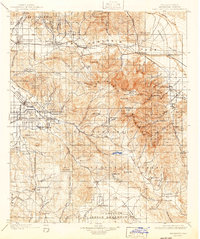
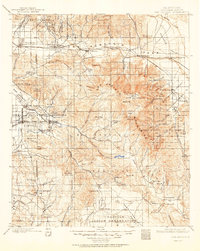
1901 Map of San Jacinto
USGS Topo · Published 1901About this map
The Southern Pacific R. R. cuts through the high desert corridor of the San Gorgonio Pass, connecting the burgeoning valley towns of Beaumont and Banning to the arid expanse of the Conchilla Desert. This turn-of-the-century landscape is defined by the massive uplift of the San Jacinto Mountains, where peaks like San Jacinto Pk. tower over nascent settlements. To the west, the San Jacinto Valley shows the organized street grids of San Jacinto and Hemet, established as agricultural hubs near the San Jacinto River.
Find a feature on this map
108 named features on this map. Tap any name to fly to it.
Don’t see what you’re looking for? This feature index may not catch every label — zoom into the map to look around manually.
Map Details
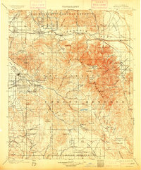
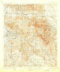
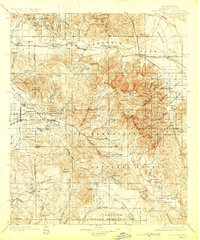
Editions of this 1901 San Jacinto Map
9 editions found

Other maps of this area

1899 · Redlands
USGS Topo · 1:62,500

1901 · Southern California Sheet No. 1
USGS Topo · 1:250,000

1901 · Redlands
USGS Topo · 1:62,500

1901 · Elsinore
USGS Topo · 1:125,000

1901 · San Luis Rey
USGS Topo · 1:125,000

1902 · San Gorgonio
USGS Topo · 1:125,000

1903 · Ramona
USGS Topo · 1:125,000

1904 · Indio
USGS Topo · 1:125,000

1904 · Southern California Sheet No. 2
USGS Topo · 1:250,000

1904 · Southern California Sheet No. 1
USGS Topo · 1:250,000