2022 Map of Catoosa
USGS Topo · Published 2022About this map
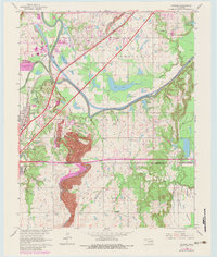
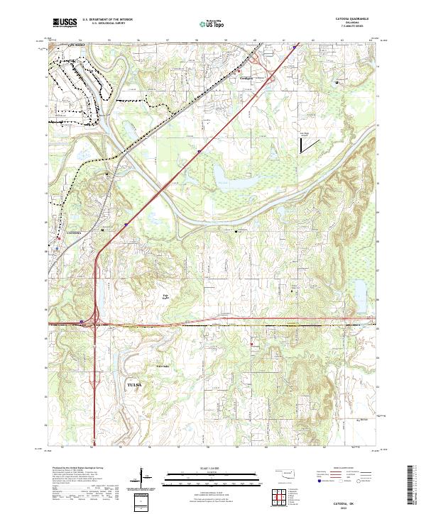
Catoosa and Verdigris anchor this detailed survey of the landscape where the Verdigris River meets the industrial and transportation corridors of northeastern Oklahoma. The map documents a complex network of waterways, including Bird Creek, Spunky Creek, and Salt Creek, alongside significant infrastructure like the BNSF Railway and major highway routes. For genealogists, the map is particularly valuable for locating numerous small burial grounds such as Marshall Cem, River Hill Cem, and Crutchfield Cem, which are often the only remaining physical markers of early settlements like Rascal Flat. The transition from the developed outskirts of Owasso and Tulsa to the riparian lowlands of Big Bottom and Big Lake illustrates the continuing evolution of land use in this river valley.
Find a feature on this map
81 named features on this map. Tap any name to fly to it.
Don’t see what you’re looking for? This feature index may not catch every label — zoom into the map to look around manually.
Map Details
Editions of this 2022 Catoosa Map
This is the sole edition of this map. No revisions or reprints were ever made.