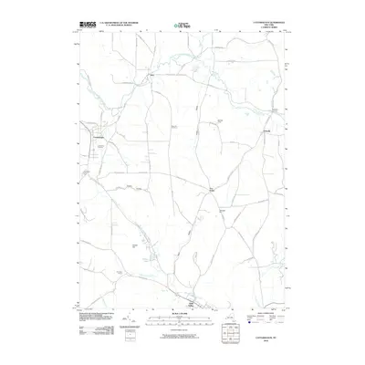
2010 Map of Cattaraugus
USGS Topo · Published 2010About this map
Cattaraugus and Little Valley serve as the primary hubs in this Western New York landscape, defined by the winding course of the South Branch Cattaraugus Creek to the north and Little Valley Creek to the south. The area is characterized by a dense network of high-elevation roads like Dunkleman Hill Rd and Buehlow Hill Rd that navigate the ridges between deep valleys such as Jersey Hollow. Genealogists and local historians can locate established burial grounds including Liberty Park Cemetery and West Hill Cemetery, alongside smaller settlements like Otto and Eddyville. The map illustrates a rural economy transitioning from traditional farming to specialized uses, evidenced by Berdick Field and the Ultralight Port near Five Points. From the waters of Linlyco Lake to the scattered crossroads of Gowan and Champlain Corners, the survey provides a clear view of the county's topographical and social structure in the early 21st century.
Find a feature on this map
74 named features on this map. Tap any name to fly to it.
Don’t see what you’re looking for? This feature index may not catch every label — zoom into the map to look around manually.
Map Details
Editions of this 2010 Cattaraugus Map
This is the sole edition of this map. No revisions or reprints were ever made.
Other maps of this area

1900 · Salamanca
USGS Topo · 1:62,500

1922 · Randolph
USGS Topo · 1:62,500

1923 · Randolph
USGS Topo · 1:62,500

1923 · Cattaraugus
USGS Topo · 1:62,500

1924 · Ellicottville
USGS Topo · 1:62,500

1938 · Cattaraugus
USGS Topo · 1:62,500

1938 · Salamanca
USGS Topo · 1:62,500

1941 · Cattaraugus
USGS Topo · 1:62,500

1941 · Ellicottville
USGS Topo · 1:62,500

1943 · Randolph
USGS Topo · 1:62,500