
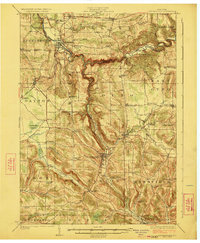
1923 Map of Cattaraugus
USGS Topo · Published 1923About this map
Gowanda and Cattaraugus serve as focal points for this 1923 survey, which illustrates the intricate intersection of indigenous land, industrial rail corridors, and rural educational hubs. The Cattaraugus Indian Reservation occupies the northwest corner, containing the State Asylum and specialized institutions like the Indian School. Transport is dominated by the Erie RR and its various branches, which navigate the deep valleys carved by Cattaraugus Creek and Thatcher Brook.
Find a feature on this map
87 named features on this map. Tap any name to fly to it.
Don’t see what you’re looking for? This feature index may not catch every label — zoom into the map to look around manually.
Map Details
Editions of this 1923 Cattaraugus Map
4 editions found
Other maps of this area

1899 · Silver Creek
USGS Topo · 1:62,500

1900 · Cherry Creek
USGS Topo · 1:62,500

1900 · Salamanca
USGS Topo · 1:62,500

1905 · Jamestown
USGS Topo · 1:62,500

1905 · Eden
USGS Topo · 1:62,500

1907 · Eden
USGS Topo · 1:62,500

1922 · Randolph
USGS Topo · 1:62,500

1923 · Randolph
USGS Topo · 1:62,500

1924 · Ellicottville
USGS Topo · 1:62,500

1925 · Springville
USGS Topo · 1:62,500