Old Maps of Erie County, New York
Explore 279 old maps of Erie County, spanning from 1894 to today. These high-resolution historic maps reveal how streets, neighborhoods, landmarks, and natural features evolved over time — perfect for genealogy, metal detecting, research, and local history exploration.
What you can do with these maps:
- See how Erie County changed over time: Compare historical maps to modern-day views to trace roads, homesites, rail lines & more.
- View detailed metadata: Each map includes creators, publishers, year, scale, and archive source.
- Overlay maps with satellite & LiDAR: Visualize the past alongside modern tools to explore terrain & human change.
- Trusted historical sources: Maps sourced from the USGS, Library of Congress, and other archives.
- Access maps your way: View online, download high-res files, or order prints for personal or research use.
Start exploring old maps of Erie County to uncover forgotten places, hidden landmarks, and the deep history beneath your feet.
Erie County, NY maps
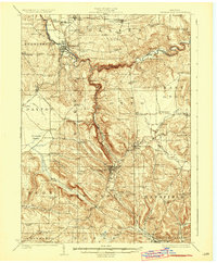
(279)- 1894 Map of Buffalo
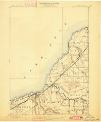
 1894 Buffalo1894 Print · USGSBuffalo and its lakefront suburbs are captured at a peak of maritime and rail expansion in the 1890s. Genealogists and local historians can trace the early streets of Kenmore, the path of the Erie Canal, and landmarks like the Fort Erie (Ruins).2 unique versions available
 - 1894 Map of Niagara Falls
 1894 Niagara Falls1894 Print · USGSThe Niagara frontier in the early 1890s shows a landscape of strategic forts and burgeoning rail power. Trace the international border from Fort Niagara past the Brock Monument to the rail hubs at Suspension Bridge.
 - 1896 Map of Niagara Falls
 1896 Niagara Falls1896 Print · USGSThe Niagara frontier at the close of the nineteenth century was a landscape of international boundaries and massive engineering. Trace the complex rail networks through Suspension Bridge or the historic fortifications at Fort Niagara and Fort Massassauga.2 unique versions available
 - 1897 Map of Tonawanda
 1897 Tonawanda1897 Print · USGSNiagara and Erie counties thrived at the close of the nineteenth century as vital corridors of commerce. Genealogists and historians can trace the early rail networks through Pekin or locate riverside landmarks like Sour Spring Grove and the Erie Canal.
 - 1897 Map of Medina
 1897 Medina1897 Print · USGSWestern New York at the close of the nineteenth century reveals a landscape defined by the Erie Canal and the Tonawanda Indian Reservation. Researchers can trace the early rail-and-water economy through settlements like Medina, Akron, and the vanished stops of Smithville Sta.7 unique versions available
 - 1897 Map of Lockport
 1897 Lockport1897 Print · USGSNiagara County was a powerhouse of canal and rail commerce during the 1890s, centered on the engineering marvels at Lockport. Genealogists and historians can trace the early foundations of Clarence Center, locate Swifts Mills, or follow the original path of the Erie Canal past Raynales Basin.
 - 1899 Map of Silver Creek
 1899 Silver Creek1899 Print · USGSThe Lake Erie shoreline and its industrial rail corridors are captured here at the close of the nineteenth century. Researchers can trace the early layout of Angola and Silver Creek or locate landmarks within the Cattaraugus Indian Reservation.7 unique versions available
 - 1899 Map of Niagara
 1899 Niagara1899 Print · USGSThe Niagara Frontier is mapped here in the late nineteenth century as a bustling corridor of trade and transport. Researchers can trace the path of the Erie Canal through Lockport or locate early rural settlements like Ransomville and the Tuscarora Indian Reservation.6 unique versions available
 - 1900 Map of Tonawanda
 1900 Tonawanda1900 Print · USGSNiagara County and northern Erie County are shown at the turn of the century as the Erie Canal and heavy rail lines drove the growth of the North Tonawanda lumber and shipping hub. Genealogists can trace family footprints in outlying hamlets like Bergholtz, Ransomville, and Martinsville.
 - 1900 Map of Niagara Falls, 1961 Print
 1900 Niagara Falls1961 Print · USGSThe Niagara frontier at the turn of the century shows an intense convergence of industrial power and military history along the international border. Trace the rail-and-river economy through the Suspension Bridge and Michigan Central R. R. or locate old landmarks like Fort Niagara and the Whirlpool.4 unique versions available
 - 1901 Map of Buffalo
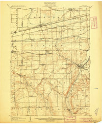
 1901 Buffalo1901 Print · USGSBuffalo was a bustling transportation hub at the dawn of the century, where the Great Lakes met the canal and rail networks. Genealogists can trace family roots in early suburbs like Kenmore or locate ancestral sites near Pine Hill Cemetery and Harlem Station.12 unique versions available
 - 1901 Map of Niagara Falls
 1901 Niagara Falls1901 Print · USGSThe Niagara frontier at the dawn of the twentieth century is captured here in striking detail, from the river's mouth to the falls. Trace the dense rail networks of the Niagara Falls area or locate Fort Niagara and the Brock Monument.11 unique versions available
 - 1901 Map of Tonawanda
 1901 Tonawanda1901 Print · USGSAt the turn of the century, the Niagara Frontier was a powerhouse of canal and rail transit. Genealogists can trace family footprints in settlements like Sanborn, Martinsville, and Bergholtz, or follow the original path of the ERIE CANAL through Tonawanda.7 unique versions available
 - 1902 Map of Lockport
 1902 Lockport1902 Print · USGSNiagara and Erie Counties thrived at the turn of the century as the Erie Canal and heavy rail transformed the region. Researchers can trace ancestral property near Lockport or locate vanished stops along the Batavia and Tonawanda Shore Line and near Reynales Basin.6 unique versions available
 - 1905 Map of Attica
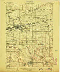
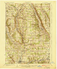
 1905 Attica1905 Print · USGSWestern New York at the turn of the century shows a landscape dominated by a massive web of competing railroads. Genealogists can trace family names and small hamlets like Folsomdale, Darien Center, and the industrial hub at Attica.5 unique versions available
 - 1905 Map of Depew
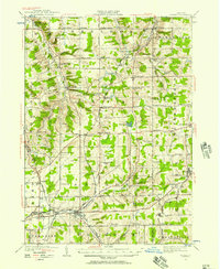
 1905 Depew1905 Print · USGSEastern Erie County at the height of the steam era reveals a complex network of major rail lines and rural hamlets. Genealogists and historians can trace old property lines and rail stations like Looneyville, Grimesville, and the early development of Depew.6 unique versions available
 - 1905 Map of Lockport, 1906 Print
 1905 Lockport1906 Print · USGSNiagara and Erie counties at the height of the canal and rail era show a landscape defined by the Erie Canal. Trace family roots in Lockport or explore early transit networks through Transit Sta., Akron, and the Electric R. R.
 - 1905 Map of Eden, 1961 Print
 1905 Eden1961 Print · USGSWestern New York at the turn of the century reveals a landscape of growing rail towns and lakefront retreats. Genealogists can trace family roots in North Collins or follow the early tracks of the Lake Shore and Michigan Southern.
 - 1907 Map of Eden
 1907 Eden1907 Print · USGSSouthern Erie County at the turn of the century reveals a landscape of growing towns and busy rail lines carving through deep creek valleys. Genealogists and historians can trace family locations in North Collins, Eden Valley, and the Cattaraugus Indian Reservation.4 unique versions available
 - 1923 Map of Cattaraugus
 1923 Cattaraugus1923 Print · USGSWestern New York's rugged hill country is captured here during the early twenties, showing a landscape defined by deep creek valleys and a dense network of country schools. Genealogists can trace family locations near landmarks like the State Asylum, Judd Corners, or the dozens of rural schoolhouses such as Rosenburg School.4 unique versions available
 - 1923 Map of Arcade, 1957 Print
 1923 Arcade1957 Print · USGSWyoming County is captured in the early 1920s, showing a landscape defined by dairy farming and the vital rail connections of the Arcade and Attica. Genealogists can trace family names at Hicks Corners and Toziers Corners, or locate rural landmarks like Klein School and Java Lake.2 unique versions available
 - 1924 Map of Ellicottville
 1924 Ellicottville1924 Print · USGSCattaraugus County’s steep valleys and rural schools are preserved here in the mid-1920s, showing the region's transition into the early automotive age. Trace family roots and vanished landmarks like Cascade Park, the Dutch Hill Church, and the Buffalo Rochester and Pittsburgh Railroad corridor.3 unique versions available
 - 1925 Map of Springville
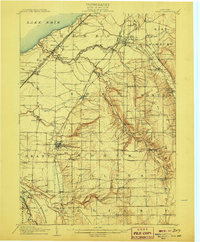
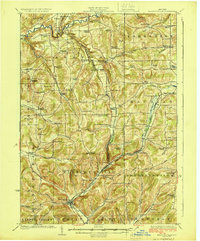
 1925 Springville1925 Print · USGSSouthern Erie County in the mid-twenties shows a landscape of deep valleys and rail-connected villages before the expansion of modern highways. Genealogists can trace family footprints through dozens of district schools like Wheeler Hollow School and rural centers such as Sardinia and Griffins Mills.5 unique versions available
 - 1925 Map of Arcade
 1925 Arcade1925 Print · USGSWestern New York’s rural landscape is captured here in the mid-1920s, a time when one-room schoolhouses and family-named crossroads still defined the countryside. Genealogists can trace property vicinities near Java Village, locate the elusive Cheery Tavern, or follow the path of the Arcade and Attica railroad.4 unique versions available
 - 1938 Map of Cattaraugus
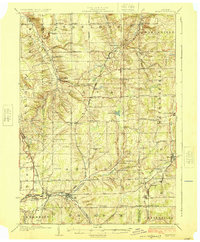
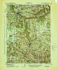 1938 Cattaraugus1938 Print · USGSWestern New York in the late thirties is captured here during a transition to modern mapping, anchored by the Erie railroad and the Cattaraugus Indian Reservation. Researchers can trace dozens of local landmarks like the State Asylum, Zoar Bridge, and the Poverty Hill School.
Showing maps 1-25 of 279
Top cities of Erie County
- Buffalo historical maps
- Amherst historical maps
- Cheektowaga historical maps
- Tonawanda historical maps
- Hamburg historical maps
- West Seneca historical maps
See more
Frequently asked questions
- What are the different types of historical maps available for Erie County?
- What is the oldest map of Erie County?
- Where can I purchase historical maps of Erie County for my home or office?
- Where can I download high-res historical maps of Erie County?
- Are there historical topographic maps available for Erie County?
- Is there historical aerial imagery available for Erie County?
- Where are historical maps of Erie County sourced from?