2020s Maps of Erie County, New York
Explore 33 historic maps of Erie County from the 2020s. These maps offer a rare glimpse into what life looked like during the 2020s — showing old roads, neighborhoods, homes, and landmarks that have changed or disappeared over time.
Whether you're researching your family's past, planning a metal detecting trip, or studying how Erie County's landscape evolved across the 2020s, these high-resolution maps are a powerful tool for exploring the history of this region.
- Focus on a specific era: All maps on this page are from the 2020s, giving you a focused view of this time period.
- See what’s changed: Compare century-old streets, trails, and buildings to today's modern landscape using overlays and satellite layers.
- Research with precision: Use these maps for genealogy, historical research, land use analysis, or educational projects.
- View, download, or print: Maps are fully viewable online in high resolution, and can be downloaded or printed for your own records.
Start exploring Erie County's history through authentic maps from the 2020s. This is your window into the past.
Erie County, NY maps
(33)- 2023 Map of Buffalo NW OE W, 2023 Print
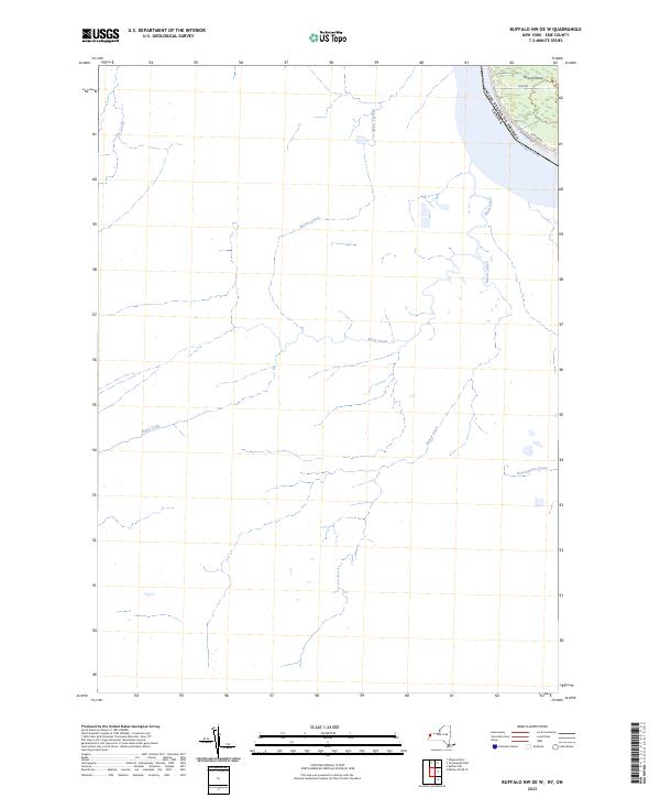 2023 Buffalo NW OE W2023 Print · USGSThe Niagara frontier at the international border comes into focus in this contemporary survey of the river and shoreline. Trace the western edge of Grand Island and the winding paths of Black Creek and Frenchman's Creek.
 - 2023 Map of Clarence Center, 2023 Print
 2023 Clarence Center2023 Print · USGSClarence Center and the surrounding Erie County suburbs appear in great detail during the early twenty-first century. Researchers can locate family sites at Saint Pauls Cem, trace the Erie Canal, or explore the airfield at Clarence Aerodrome.
 - 2023 Map of Clarence, 2023 Print
 2023 Clarence2023 Print · USGSErie County's eastern hamlets are captured in this recent survey, showcasing a landscape defined by historic burial grounds and winding creeks. Researchers can trace family history at the Schopf Pioneer Cem, Mount Olive Cem, and Town Line Station.
 - 2023 Map of Sardinia, 2023 Print
 2023 Sardinia2023 Print · USGSWestern New York’s rural uplands are shown in high detail at the start of the 2020s, spanning the rolling terrain between the villages of Holland and Sardinia. Researchers can trace old family burial grounds at Pratham Cem or follow the dramatic topography of Richmond Gulf and Cattaraugus Creek.
 - 2023 Map of Holland, 2023 Print
 2023 Holland2023 Print · USGSErie County's rural townships are documented in detail here during the early twenty-first century, showing the enduring valley settlements of South Wales and Holland. Family history researchers can trace several burial sites including Humphrey Cem and Holmes Hill Cem along the ridges.
 - 2023 Map of Springville, 2023 Print
 2023 Springville2023 Print · USGSSpringville and the surrounding townships of Erie County are shown in detail during the early 2020s. Researchers can locate numerous local landmarks including Maplewood Cem, the hamlets of East Concord and Glenwood, and the winding path of Eighteenmile Creek.
 - 2023 Map of East Aurora, 2023 Print
 2023 East Aurora2023 Print · USGSThe Erie County village of East Aurora and its neighboring hamlets are captured here in the early twenty-first century. Researchers can trace historic cemeteries like Maple Rest Cem and old transit routes such as Two Rod Rd and Four Rod Rd.
 - 2023 Map of Lancaster, 2023 Print
 2023 Lancaster2023 Print · USGSErie County's eastern suburbs and the busy aviation hub of Buffalo appear in this contemporary look at the evolving landscape. Genealogists and historians can locate several burial grounds including Transit Rural Cem and the War of 1812 Cem near Bowmansville.
 - 2023 Map of Arcade, 2023 Print
 2023 Arcade2023 Print · USGSThe confluence of Wyoming, Erie, and Cattaraugus counties is captured here in the early twenty-first century. Genealogists can trace family sites at Punkshire Cem, Curriers Rural Cem, and the village of Arcade.
 - 2023 Map of Corfu, 2023 Print
 2023 Corfu2023 Print · USGSThe Erie and Genesee County line in the 2020s remains a landscape of quiet hamlets and historic cemetery sites. Genealogists can trace family names at Evergreen Hill Cem or Saint Patricks Cem near the villages of Corfu and Crittenden.
 - 2023 Map of North Collins, 2023 Print
 2023 North Collins2023 Print · USGSThe rural landscape of southern Erie County comes into focus in this contemporary survey of the hamlets surrounding North Collins. Genealogists and historians can trace long-standing family landmarks like Huson Cem, the North Collins Quaker Meeting House Cem, and the winding Cattaraugus Creek.
 - 2023 Map of Cowlesville, 2023 Print
 2023 Cowlesville2023 Print · USGSWestern Wyoming County remains a landscape of quiet hamlets and winding creek valleys as seen in this recent survey. Researchers can locate family sites across several burial grounds, including Maple Lawn Cem, Fairview Cem, and the historic Persons Pioneer Cem.
 - 2023 Map of Langford, 2023 Print
 2023 Langford2023 Print · USGSSouthern Erie County in the 2020s remains a landscape of small hamlets and winding creek valleys. Genealogists and local historians can trace family locations near Dittman Cem, Marshfield, and the Mortons Corners Cem.
 - 2023 Map of Strykersville, 2023 Print
 2023 Strykersville2023 Print · USGSThe hills and creek valleys of Wyoming County are captured in this recent survey of the settlements between Wales and Java. Trace family roots at the Strykersville Pioneer Cem or follow the waters of Buffalo Creek past Johnson Falls.
 - 2023 Map of Eden, 2023 Print
 2023 Eden2023 Print · USGSCoastal Erie County meets the agricultural uplands in this recent survey of the lakefront and its tributary creeks. Genealogists and local historians can locate Evergreen Cem and North Evans Cem or trace the early aviation footprints of Hamburg Airport.
 - 2023 Map of Colden, 2023 Print
 2023 Colden2023 Print · USGSSoutheast Erie County is shown in this contemporary study of its rolling uplands and creek valleys. Genealogists and local historians can trace family-named sites across Hayes Hollow and East Boston, or locate burial sites at Saint Johns Cem and Maple Wood Cem.
 - 2023 Map of Tonawanda West, 2023 Print
 2023 Tonawanda West2023 Print · USGSThe Niagara River and its island communities are captured here in the early twenty-first century. Genealogists can locate family names at Saint Paul Lutheran Church Cem or trace the early street grids of Bergholtz and Grandyle Village.
 - 2023 Map of Tonawanda East, 2023 Print
 2023 Tonawanda East2023 Print · USGSThe Niagara-Erie county line comes into focus here along the winding path of Tonawanda Creek in the 2020s. Researchers can trace the development of suburban enclaves like Wurlitzer Park Village and Willow Ridge Estates alongside the massive University at Buffalo campus.
 - 2023 Map of Akron, 2023 Print
 2023 Akron2023 Print · USGSThe borderlands of Erie and Genesee Counties come into focus in the early twenty-first century, showcasing the village of Akron and the Oak Orchard Swamp. Genealogists can trace burial records at Saint Teresas Roman Catholic Cem or the Four Corners Cem.
 - 2023 Map of Wolcottsville, 2023 Print
 2023 Wolcottsville2023 Print · USGSThe Erie and Niagara county line runs through this landscape of creek-side hamlets and rural crossroads in the early 2020s. Trace local history at Wolcottsville, Swifts Mills, and the Trinity Lutheran Cem near the banks of Tonawanda Creek.
 - 2023 Map of Niagara Falls, 2023 Print
 2023 Niagara Falls2023 Print · USGSNiagara Falls and its immediate riverfront are captured here in the early twenty-first century, showing the modern urban grid meeting the falls. Researchers can trace local landmarks like Oakwood Cem, the Angelo Delignore Civic Building, and islands such as Goat Island and Buckhorn Island.
 - 2023 Map of Angola, 2023 Print
 2023 Angola2023 Print · USGSCoastal Erie County comes into focus in this contemporary study of the shoreline between Buffalo and the southern county line. Researchers can trace the layout of waterfront communities like Angola on the Lake, locate the Jerusalem Corners Cem, or explore the grounds of Camp Pioneer.
 - 2023 Map of Farnham, 2023 Print
 2023 Farnham2023 Print · USGSThe Erie County shoreline near Farnham and Brant is captured here in the early twenty-first century. Genealogists can locate several family and community burial grounds, including Rathburn Cem and Smith Mill Cem, while tracing the winding path of Cattaraugus Creek.
 - 2023 Map of Silver Creek, 2023 Print
 2023 Silver Creek2023 Print · USGSThe Lake Erie shoreline in Chautauqua County comes to life in this detailed recent survey of the village and its surrounding bays. Local historians can trace cemetery locations like Evergreen Lawn Cem or explore coastal landings from Fletcher Point to Hanford Bay.
 - 2023 Map of Collins Center, 2023 Print
 2023 Collins Center2023 Print · USGSThe rural border of Erie and Cattaraugus counties is captured here in the early twenty-first century, centered on the Zoar Valley. Genealogists can locate several historic burial sites, including Scrabble Hill Cem, North Otto Cem, and Brooklyn Cem.
Showing maps 1-25 of 33
Top cities of Erie County
- Buffalo historical maps
- Amherst historical maps
- Cheektowaga historical maps
- Tonawanda historical maps
- Hamburg historical maps
- West Seneca historical maps
See more
Frequently asked questions
- What are the different types of historical maps available for Erie County?
- What is the oldest map of Erie County?
- Where can I purchase historical maps of Erie County for my home or office?
- Where can I download high-res historical maps of Erie County?
- Are there historical topographic maps available for Erie County?
- Is there historical aerial imagery available for Erie County?
- Where are historical maps of Erie County sourced from?