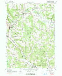
1963 Map of Cattaraugus
USGS Topo · Published 1990About this map
Cattaraugus serves as the primary hub in this early 1960s landscape, where the Erie Lackawanna railroad winds through the valleys of western New York. The map details a transition from concentrated village life to the surrounding highlands, marked by numerous family-named landmarks like Gibson Hill and Skinner Hollow. Significant local institutions are documented, including the Cattaraugus High Sch and the Cattaraugus Camp grounds, alongside the Fairgrounds located near the village center.
Find a feature on this map
78 named features on this map. Tap any name to fly to it.
Don’t see what you’re looking for? This feature index may not catch every label — zoom into the map to look around manually.
Map Details
Editions of this 1963 Cattaraugus Map
3 editions found
Other maps of this area

1900 · Salamanca
USGS Topo · 1:62,500

1922 · Randolph
USGS Topo · 1:62,500

1923 · Randolph
USGS Topo · 1:62,500

1923 · Cattaraugus
USGS Topo · 1:62,500

1924 · Ellicottville
USGS Topo · 1:62,500

1938 · Cattaraugus
USGS Topo · 1:62,500

1938 · Salamanca
USGS Topo · 1:62,500

1941 · Cattaraugus
USGS Topo · 1:62,500

1941 · Ellicottville
USGS Topo · 1:62,500

1943 · Randolph
USGS Topo · 1:62,500