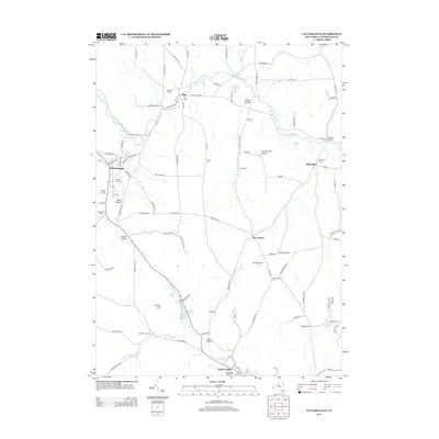
2013 Map of Cattaraugus
USGS Topo · Published 2013About this map
Cattaraugus and Little Valley anchor this landscape in the early 21st century, where the valley floors are defined by the winding paths of South Br Cattaraugus Cr and Little Valley Cr. The settlement pattern follows the high ground and creek beds, connecting rural hamlets like Otto, Eddyville, and Five Points. Numerous small burial grounds, such as Liberty Park Cem and Little Valley Rural Cem, are scattered across the terrain, reflecting the long-standing community roots in the area.
Find a feature on this map
107 named features on this map. Tap any name to fly to it.
Don’t see what you’re looking for? This feature index may not catch every label — zoom into the map to look around manually.
Map Details
Editions of this 2013 Cattaraugus Map
This is the sole edition of this map. No revisions or reprints were ever made.
Other maps of this area

1900 · Salamanca
USGS Topo · 1:62,500

1922 · Randolph
USGS Topo · 1:62,500

1923 · Randolph
USGS Topo · 1:62,500

1923 · Cattaraugus
USGS Topo · 1:62,500

1924 · Ellicottville
USGS Topo · 1:62,500

1938 · Cattaraugus
USGS Topo · 1:62,500

1938 · Salamanca
USGS Topo · 1:62,500

1941 · Cattaraugus
USGS Topo · 1:62,500

1941 · Ellicottville
USGS Topo · 1:62,500

1943 · Randolph
USGS Topo · 1:62,500