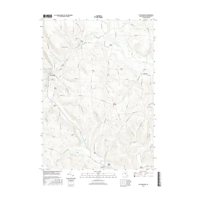
2016 Map of Cattaraugus
USGS Topo · Published 2016About this map
Cattaraugus and the surrounding township of New Albion are defined by a landscape of high ridges and carved hollows. This 2016 survey highlights a cluster of hilltop settlements and farming communities like Otto and Eddyville, connected by a network of rural roads such as Dunkleman Hill Rd and S Hill Rd. The terrain is marked by significant topographical features including Carroll Hill and several distinct valleys like Skinner Hollow and Waite Hollow. Numerous small burial grounds, including Little Valley Rural Cem and the Lutheran Cem, are scattered throughout the countryside, serving as important landmarks for local genealogy. To the south, the village of Little Valley sits near the headwaters of Little Valley Cr, while the expansive Waterman Swamp and the waters of Linlyco Lake provide a sharp contrast to the surrounding highlands.
Find a feature on this map
92 named features on this map. Tap any name to fly to it.
Don’t see what you’re looking for? This feature index may not catch every label — zoom into the map to look around manually.
Map Details
Editions of this 2016 Cattaraugus Map
This is the sole edition of this map. No revisions or reprints were ever made.
Other maps of this area

1900 · Salamanca
USGS Topo · 1:62,500

1922 · Randolph
USGS Topo · 1:62,500

1923 · Randolph
USGS Topo · 1:62,500

1923 · Cattaraugus
USGS Topo · 1:62,500

1924 · Ellicottville
USGS Topo · 1:62,500

1938 · Cattaraugus
USGS Topo · 1:62,500

1938 · Salamanca
USGS Topo · 1:62,500

1941 · Cattaraugus
USGS Topo · 1:62,500

1941 · Ellicottville
USGS Topo · 1:62,500

1943 · Randolph
USGS Topo · 1:62,500