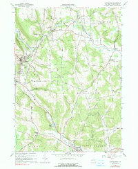
2023 Map of Cattaraugus
USGS Topo · Published 2023About this map
Cattaraugus and the village of Little Valley anchor this modern topographic view of Cattaraugus County, characterized by a series of narrow valleys or hollows that dictate the region's transport and settlement patterns. The village of Little Valley serves as a focal point, hosting the Cattaraugus County Courthouse and the Little Valley Rural Cem. Between these primary settlements, the landscape is defined by drainage features like the South Branch Cattaraugus Creek and the southern Little Valley Creek, which flows past the waters of Linlyco Lake.
Find a feature on this map
107 named features on this map. Tap any name to fly to it.
Don’t see what you’re looking for? This feature index may not catch every label — zoom into the map to look around manually.
Map Details
Editions of this 2023 Cattaraugus Map
This is the sole edition of this map. No revisions or reprints were ever made.
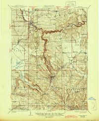
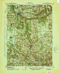
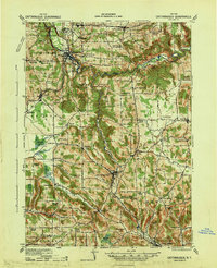
Historical Maps of Persia Through Time
5 maps found