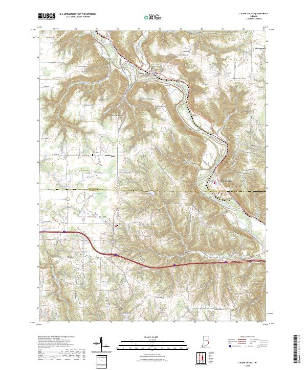
2022 Map of Cedar Grove
USGS Topo · Published 2022About this map
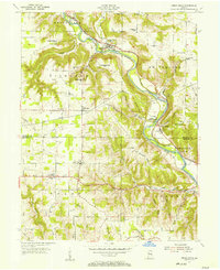
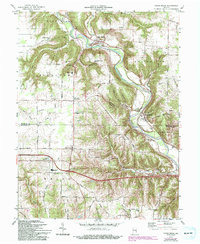
The Whitewater River cuts a deep, winding valley through this pocket of southeastern Indiana, shaping the development of settlements like Cedar Grove and New Trenton. High ground is defined by distinct landmarks such as English Hill and Gobblers Knob Hill, which overlook the complex drainage of Gobbles Cr and Logan Creek. For those tracing local history, the map identifies several significant burial grounds and parish centers, including Holy Guardian Angels Cem and Saint Johns Cem near South Gate.
Find a feature on this map
36 named features on this map. Tap any name to fly to it.
Don’t see what you’re looking for? This feature index may not catch every label — zoom into the map to look around manually.
Map Details
Editions of this 2022 Cedar Grove Map
This is the sole edition of this map. No revisions or reprints were ever made.
Historical Maps of South Gate Through Time
3 maps found