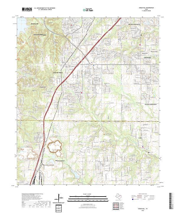
2022 Map of Cedar Hill
USGS Topo · Published 2022About this map
Cedar Hill sits at the center of this 2022 survey, illustrating the suburban expansion along the Hwy 67 corridor. This modern landscape is defined by its topographical transitions, from the high vantage point of Inspiration Point and the elevations of Cedar Bluff down to the sprawling waters of Joe Pool Lake in the northwest. While much of the area reflects dense residential growth in towns like DeSoto, Duncanville, and Grand Prairie, older rural roots are still visible in the southern reaches.
Find a feature on this map
49 named features on this map. Tap any name to fly to it.
Don’t see what you’re looking for? This feature index may not catch every label — zoom into the map to look around manually.
Map Details
Editions of this 2022 Cedar Hill Map
This is the sole edition of this map. No revisions or reprints were ever made.
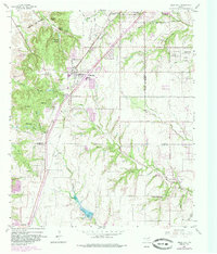
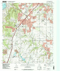
Historical Maps of Dallas Through Time
3 maps found