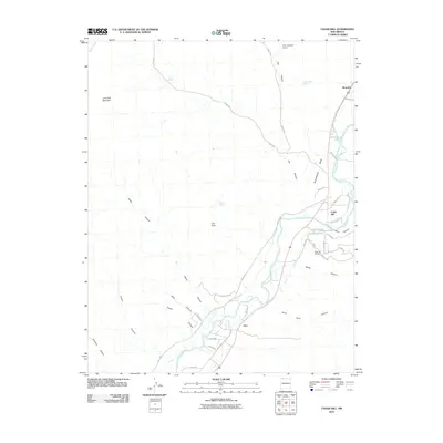
2010 Map of Cedar Hill
USGS Topo · Published 2010About this map
The Animas River corridor shapes the life and industry of this San Juan County landscape, providing the water source for critical irrigation works like the Stacy Ditch and the Graves Atterberry Ditch. These human-made channels parallel the river's winding course, supporting the small settlements of Riverside, Cedar Hill, and Inca. To the west, the terrain rises sharply into a series of deeply carved drainages including Kitten Canyon and Bohanan Canyon, leading toward the prominent heights of Lone Tree Mountain. This 2010 survey reflects a high desert environment where historical settlement remains concentrated near the river, while landmarks like Lion Rock and Cox Canyon Arch punctuate the arid mesas. Local history is anchored at the Cedar Hill Cemetery, overlooking the valley and the network of county roads that connect these small northern New Mexico communities.
Find a feature on this map
47 named features on this map. Tap any name to fly to it.
Don’t see what you’re looking for? This feature index may not catch every label — zoom into the map to look around manually.
Map Details
Editions of this 2010 Cedar Hill Map
This is the sole edition of this map. No revisions or reprints were ever made.
Other maps of this area

1889 · Largo
USGS Topo · 1:250,000

1889 · Chaco
USGS Topo · 1:250,000

1892 · Chaco
USGS Topo · 1:250,000

1895 · Largo
USGS Topo · 1:250,000

1908 · Ignacio
USGS Topo · 1:125,000

1913 · Red Mesa
USGS Topo · 1:62,500

1924 · Ignacio
USGS Topo · 1:125,000

1945 · Durango
USGS Topo · 1:250,000

1953 · Durango
USGS Topo · 1:250,000

1954 · Durango
USGS Topo · 1:250,000