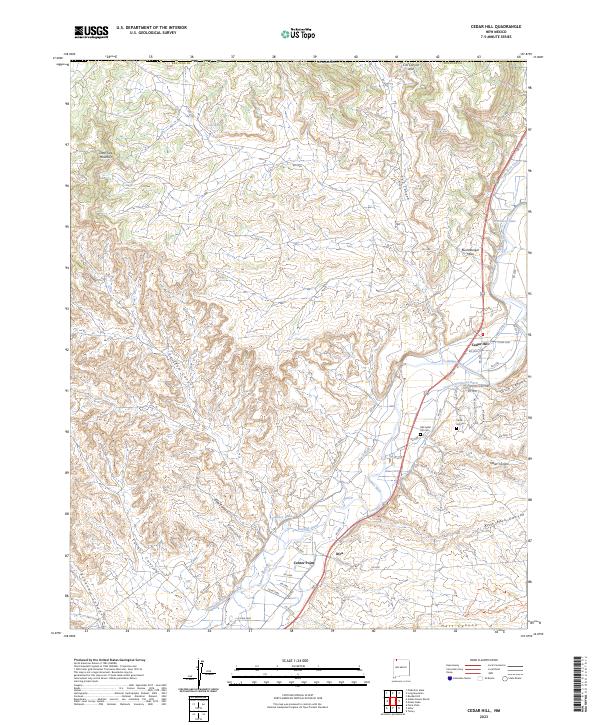
2023 Map of Cedar Hill
USGS Topo · Published 2023About this map
The Animas River valley serves as the central artery for this part of San Juan County, New Mexico, where a sophisticated network of irrigation channels supports the local landscape. Engineered waterways like Stacy Ditch, Sargent Ditch, and the Graves Atterberry Ditch branch off the river to hydrate the valley floor. The settlement of Cedar Hill is established at the base of Bushelberger Mesa, serving as a focal point for the region's historical and genealogical record with both the Old Cedar Hill Cem and the newer Cedar Hill Cem located nearby. To the south, the small community of Inca sits near Center Point, illustrating the clustered nature of development along the primary water source. The surrounding high country is defined by dramatic geological features such as Lone Tree Mountain and the Cox Canyon Arch, with numerous drainage systems like Kiffen Canyon and Bohanan Canyon carving into the mesas.
Find a feature on this map
66 named features on this map. Tap any name to fly to it.
Don’t see what you’re looking for? This feature index may not catch every label — zoom into the map to look around manually.
Map Details
Editions of this 2023 Cedar Hill Map
This is the sole edition of this map. No revisions or reprints were ever made.
Other maps of this area

1889 · Largo
USGS Topo · 1:250,000

1889 · Chaco
USGS Topo · 1:250,000

1892 · Chaco
USGS Topo · 1:250,000

1895 · Largo
USGS Topo · 1:250,000

1908 · Ignacio
USGS Topo · 1:125,000

1913 · Red Mesa
USGS Topo · 1:62,500

1924 · Ignacio
USGS Topo · 1:125,000

1945 · Durango
USGS Topo · 1:250,000

1953 · Durango
USGS Topo · 1:250,000

1954 · Durango
USGS Topo · 1:250,000