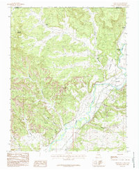
1985 Map of Cedar Hill
USGS Topo · Published 1985About this map
The Animas River corridor near the Colorado border serves as the primary artery for settlement and industry in this 1980s landscape. Near the riverside hamlet of Riverside, the valley floor supports agricultural life while an Old RR Grade and an Abandoned Bridge near Cedar Hill mark the footprint of earlier transportation networks. The surrounding high country, including Bushelberger Mesa and Lone Tree Mountain, is heavily marked by energy development, with numerous Gas Wells and the extensive Gas Field scattered across the rugged terrain.
Find a feature on this map
23 named features on this map. Tap any name to fly to it.
Don’t see what you’re looking for? This feature index may not catch every label — zoom into the map to look around manually.
Map Details
Editions of this 1985 Cedar Hill Map
This is the sole edition of this map. No revisions or reprints were ever made.
Other maps of this area

1889 · Largo
USGS Topo · 1:250,000

1889 · Chaco
USGS Topo · 1:250,000

1892 · Chaco
USGS Topo · 1:250,000

1895 · Largo
USGS Topo · 1:250,000

1908 · Ignacio
USGS Topo · 1:125,000

1913 · Red Mesa
USGS Topo · 1:62,500

1924 · Ignacio
USGS Topo · 1:125,000

1945 · Durango
USGS Topo · 1:250,000

1953 · Durango
USGS Topo · 1:250,000

1954 · Durango
USGS Topo · 1:250,000