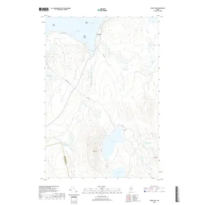
2018 Map of Cedar Lake
USGS Topo · Published 2018About this map
Perkins sits along the narrow passage between North Twin Lake and South Twin Lake, serving as a central point in this network of interconnected waterways. The landscape is defined by its significant "deadwater" sections, including Grant Brook Deadwater and Dean Brook Deadwater, where sluggish stream currents expand into wetland basins. These features, along with Rocky Bog and Libby Bog, indicate a terrain where water drainage is slow and complex, centered around the prominence of Cedar Mtn. The map traces the boundary between Piscataquis and Penobscot counties, cutting through a landscape of timber-access routes like Lincolnridge Rd and Cedar Lake Rd. From the islands of the Twin Lakes, such as Peanut Island and Little Birch Island, to the isolated waters of Flatiron Pond, the map details a region where logging roads and natural watercourses dictate the human footprint.
Find a feature on this map
33 named features on this map. Tap any name to fly to it.
Don’t see what you’re looking for? This feature index may not catch every label — zoom into the map to look around manually.
Map Details
Editions of this 2018 Cedar Lake Map
This is the sole edition of this map. No revisions or reprints were ever made.
Other maps of this area

1942 · Lincoln
USGS Topo · 1:62,500

1947 · Schoodic
USGS Topo · 1:62,500

1949 · Schoodic
USGS Topo · 1:62,500

1951 · Norcross
USGS Topo · 1:62,500

1951 · Millinocket
USGS Topo · 1:62,500

1954 · Millinocket
USGS Topo · 1:250,000

1957 · Lincoln
USGS Topo · 1:62,500

1958 · Millinocket
USGS Topo · 1:250,000

1960 · Millinocket
USGS Topo · 1:250,000

1975 · Millinocket SW
USGS Topo · 1:24,000
Featured Places
- T3 Indian Purchase Township, ME
- Hopkins Academy Grant Township, ME
- Long A Township, ME
- T4 Indian Purchase Township, ME
- T4 R9 NWP, ME