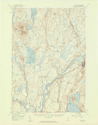
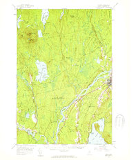
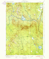
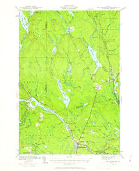
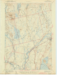
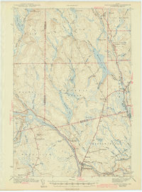
1957 Map of Lincoln
USGS Topo · Published 1959About this map
Lincoln and Howland anchor this mid-century portrait of the Penobscot River valley, where the water and rail lines defined the regional economy. The Maine Central and Canadian Pacific railroads trace the riverbanks, connecting industrial points and small settlements like South Lincoln and West Enfield. The landscape is dominated by complex water systems, from the expansive South Branch Lake and Mattamiscontis Lake to the bog-heavy terrain of Keene Bog and Stinking Bog.
Find a feature on this map
107 named features on this map. Tap any name to fly to it.
Don’t see what you’re looking for? This feature index may not catch every label — zoom into the map to look around manually.
Map Details
Editions of this 1957 Lincoln Map
3 editions found

Other maps of this area

1917 · Passadumkeag
USGS Topo · 1:62,500

1920 · Winn
USGS Topo · 1:62,500

1931 · Saponac
USGS Topo · 1:48,000

1933 · Boyd Lake
USGS Topo · 1:62,500
1934 · Saponac
USGS Topo · 1:62,500
1940 · Mattawamkeag
USGS Topo · 1:62,500
1942 · Lincoln
USGS Topo · 1:62,500
1942 · Mattawamkeag
USGS Topo · 1:62,500

1947 · Schoodic
USGS Topo · 1:62,500

1949 · Schoodic
USGS Topo · 1:62,500