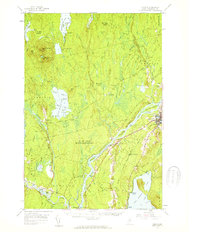
1957 Map of Lincoln
USGS Topo · Published 1959About this map
The Penobscot River flows through the heart of this mid-century survey, dividing the landscape into a complex network of islands and rapids. All islands within the river, including Mohawk I and Mattanawcook Island, are noted as part of the Penobscot Indian Reservation. The river serves as the primary corridor for industry and transport, anchored by the West Enfield Dam and the settlement of Lincoln. The regional economy is further defined by the intersection of the Maine Central and Canadian Pacific railroads, which facilitated movement through the dense woods and boggy lowlands.
Find a feature on this map
113 named features on this map. Tap any name to fly to it.
Don’t see what you’re looking for? This feature index may not catch every label — zoom into the map to look around manually.
Map Details
Editions of this 1957 Lincoln Map
3 editions found

Other maps of this area

1917 · Passadumkeag
USGS Topo · 1:62,500

1920 · Winn
USGS Topo · 1:62,500

1931 · Saponac
USGS Topo · 1:48,000

1933 · Boyd Lake
USGS Topo · 1:62,500

1934 · Saponac
USGS Topo · 1:62,500

1940 · Mattawamkeag
USGS Topo · 1:62,500

1942 · Lincoln
USGS Topo · 1:62,500

1942 · Mattawamkeag
USGS Topo · 1:62,500

1947 · Schoodic
USGS Topo · 1:62,500

1949 · Schoodic
USGS Topo · 1:62,500