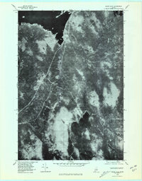
1978 Map of Cedar Lake
USGS Topo · Published 1981About this map
Cedar Lake and the surrounding Maine wilderness are captured in this 1978 orthophotomap, showing the landscape through rectified aerial photography. This specific format offers a direct visual record of the forest canopy, wetlands, and water bodies as they appeared in the late 1970s, rather than the interpreted symbols of a traditional topographic map. The northern edge of the sheet is dominated by the expansive South Twin Lake, while the southern portion features the irregular shoreline of Cedar Lake and the northern tip of Endless Lake.
Find a feature on this map
6 named features on this map. Tap any name to fly to it.
Don’t see what you’re looking for? This feature index may not catch every label — zoom into the map to look around manually.
Map Details
Editions of this 1978 Cedar Lake Map
This is the sole edition of this map. No revisions or reprints were ever made.
Other maps of this area

1942 · Lincoln
USGS Topo · 1:62,500

1947 · Schoodic
USGS Topo · 1:62,500

1949 · Schoodic
USGS Topo · 1:62,500

1951 · Norcross
USGS Topo · 1:62,500

1951 · Millinocket
USGS Topo · 1:62,500

1954 · Millinocket
USGS Topo · 1:250,000

1957 · Lincoln
USGS Topo · 1:62,500

1958 · Millinocket
USGS Topo · 1:250,000

1960 · Millinocket
USGS Topo · 1:250,000

1975 · Millinocket SW
USGS Topo · 1:24,000
Featured Places
- T3 Indian Purchase Township, ME
- T4 R9 NWP, ME
- Long A Township, ME
- Cedar Lake Township, ME
- Hopkins Academy Grant Township, ME