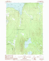
1988 Map of Cedar Lake
USGS Topo · Published 1988About this map
Cedar Mountain rises as the central topographical anchor between the sprawling waters of Cedar Lake and the northern reaches of South Twin Lake. This landscape, documented in the late 1980s, reveals a network of industrial and recreational footprints within the unorganized territories of Penobscot and Piscataquis counties. The presence of Ingalls Siding and Old Long A Siding along the rail corridor highlights the area's history of timber transport and logistical support for the remote interior.
Find a feature on this map
42 named features on this map. Tap any name to fly to it.
Don’t see what you’re looking for? This feature index may not catch every label — zoom into the map to look around manually.
Map Details
Editions of this 1988 Cedar Lake Map
This is the sole edition of this map. No revisions or reprints were ever made.
Other maps of this area

1942 · Lincoln
USGS Topo · 1:62,500

1947 · Schoodic
USGS Topo · 1:62,500

1949 · Schoodic
USGS Topo · 1:62,500

1951 · Norcross
USGS Topo · 1:62,500

1951 · Millinocket
USGS Topo · 1:62,500

1954 · Millinocket
USGS Topo · 1:250,000

1957 · Lincoln
USGS Topo · 1:62,500

1958 · Millinocket
USGS Topo · 1:250,000

1960 · Millinocket
USGS Topo · 1:250,000

1975 · Millinocket SW
USGS Topo · 1:24,000
Featured Places
- T3 Indian Purchase Township, ME
- T4 R9 NWP, ME
- Long A Township, ME
- Cedar Lake Township, ME
- Hopkins Academy Grant Township, ME