
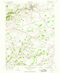
1955 Map of Cedarville
USGS Topo · Published 1956About this map
Cedarville and its surrounding townships define this mid-century landscape, dominated by a rural network of roads and the dual influence of academic and rail centers. Higher education is a prominent fixture of the area, with both Cedarville College and Central State College at Wilberforce established in the northern and western reaches of the sheet. The terrain is deeply inscribed by the movement of goods and people, characterized by the Pennsylvania railroad line passing through the heart of the village and the Baltimore and Ohio cutting across the central plains toward New Jasper Station. Small agrarian settlements like New Jasper and Monroe are linked by named thoroughfares such as Federal Road and Straley Road, reflecting a long-standing settlement pattern. The hydrology of the region is anchored by Massies Creek and the meandering Caesar Creek, which shape the topography of the many family farms and historic cemeteries, including Massies Creek Cem and Turnbull Cem.
Find a feature on this map
56 named features on this map. Tap any name to fly to it.
Don’t see what you’re looking for? This feature index may not catch every label — zoom into the map to look around manually.
Map Details
Editions of this 1955 Cedarville Map
2 editions found
Other maps of this area

1904 · Springfield
USGS Topo · 1:62,500

1906 · Springfield
USGS Topo · 1:62,500

1907 · South Charleston
USGS Topo · 1:62,500

1916 · Octa
USGS Topo · 1:62,500

1917 · Xenia
USGS Topo · 1:62,500

1944 · Octa
USGS Topo · 1:62,500

1947 · Columbus
USGS Topo · 1:250,000

1954 · Clifton
USGS Topo · 1:24,000

1955 · New Burlington
USGS Topo · 1:24,000
1955 · Yellow Springs
USGS Topo · 1:24,000