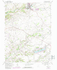
1968 Map of Cedarville
USGS Topo · Published 1988About this map
Cedarville stands as a focal point in this Greene County landscape, dominated by the campuses of Cedarville College and Central State College at Wilberforce. The map captures the agricultural and institutional character of the region in the late 1960s, with updates into the 1980s that show the expansion of Shawnee Hills around the waters of Shawnee Lake. Transport patterns are defined by the convergence of several rural routes and the infrastructure of the Wilberforce Switch and the New Jasper Station. Small-scale local industry is present through a Quarry and Gravel Pit near the South Fork, while the rural social fabric is visible in features like the Cedar Cliff School and the Caesar Creek Cemetery. The terrain transitions from the elevations of Cedar Cliff down to the drainage of Massies Creek and Caesar Creek, reflecting a well-settled township system of family-named roads and scattered farmsteads.
Find a feature on this map
60 named features on this map. Tap any name to fly to it.
Don’t see what you’re looking for? This feature index may not catch every label — zoom into the map to look around manually.
Map Details
Editions of this 1968 Cedarville Map
3 editions found
Other maps of this area

1904 · Springfield
USGS Topo · 1:62,500

1906 · Springfield
USGS Topo · 1:62,500

1907 · South Charleston
USGS Topo · 1:62,500

1916 · Octa
USGS Topo · 1:62,500

1917 · Xenia
USGS Topo · 1:62,500

1944 · Octa
USGS Topo · 1:62,500

1947 · Columbus
USGS Topo · 1:250,000

1954 · Clifton
USGS Topo · 1:24,000

1955 · New Burlington
USGS Topo · 1:24,000
1955 · Yellow Springs
USGS Topo · 1:24,000