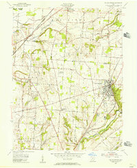
1955 Map of Yellow Springs
USGS Topo · Published 1956About this map
The village of Yellow Springs serves as the cultural hub of this mid-century landscape, anchored by the campus of Antioch College and surrounded by a web of rural townships including Miami and Bath. The map reveals a transition from the village center to the agricultural and industrial reaches of Greene County, marked by numerous quarries and the expansive U S Military Reservation to the west. Settlement patterns follow the natural corridors formed by the Little Miami River and the Mad River, which define the northern and southern drainage.
Find a feature on this map
55 named features on this map. Tap any name to fly to it.
Don’t see what you’re looking for? This feature index may not catch every label — zoom into the map to look around manually.
Map Details
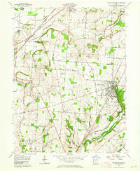
Editions of this 1955 Yellow Springs Map
2 editions found
Other maps of this area

1904 · Springfield
USGS Topo · 1:62,500

1904 · Dayton
USGS Topo · 1:62,500

1906 · Dayton
USGS Topo · 1:62,500

1906 · Springfield
USGS Topo · 1:62,500

1913 · Waynesville
USGS Topo · 1:62,500

1915 · Waynesville
USGS Topo · 1:62,500

1917 · Xenia
USGS Topo · 1:62,500

1947 · Columbus
USGS Topo · 1:250,000

1953 · Cincinnati
USGS Topo · 1:250,000

1954 · Clifton
USGS Topo · 1:24,000