
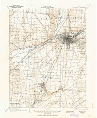
1904 Map of Springfield
USGS Topo · Published 1952About this map
The industrial and transportation hub of Springfield dominates this early twentieth-century survey, revealing a landscape where turnpikes and rail lines converged along the Mad River. The city’s core is dense with rail infrastructure, including the Springfield and Urbana Electric Railway and the Cincinnati Line. Significant social institutions are clearly marked on the urban periphery, such as the Masonic Home, the I O O F Home, and the K P Home, alongside the expansive grounds of Ferncliff Cemetery.
Find a feature on this map
77 named features on this map. Tap any name to fly to it.
Don’t see what you’re looking for? This feature index may not catch every label — zoom into the map to look around manually.
Map Details
Editions of this 1904 Springfield Map
2 editions found
Other maps of this area

1904 · Dayton
USGS Topo · 1:62,500

1906 · Dayton
USGS Topo · 1:62,500

1906 · Springfield
USGS Topo · 1:62,500

1907 · South Charleston
USGS Topo · 1:62,500

1913 · Waynesville
USGS Topo · 1:62,500

1914 · Troy
USGS Topo · 1:62,500

1914 · St. Paris
USGS Topo · 1:62,500

1914 · Mechanicsburg
USGS Topo · 1:62,500

1915 · Waynesville
USGS Topo · 1:62,500

1916 · Mechanicsburg
USGS Topo · 1:62,500