Loading...
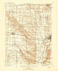
Loading map...1914 Map of St. Paris
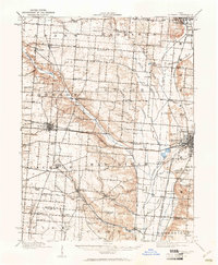
USGS Topo · Published 1954About this map
The Mad River corridor dominates this western Ohio landscape, creating a broad drainage basin that defined early 20th-century settlement patterns. Anchored by the major junction at Urbana and the village of St Paris, the area is characterized by a dense network of country schools and named rural crossroads. Local life centered around institutions like the Wesley Chapel School and the County Infirmary, while the landscape is dotted with smaller points like Carysville and Rosewood.
Find a feature on this map
89 named features on this map. Tap any name to fly to it.
Don’t see what you’re looking for? This feature index may not catch every label — zoom into the map to look around manually.
Map Details
Date Portrayed1914
Date Published1954
PublisherU.S. Geological Survey
Map TypeTopographic
Scale1:62,500
Physical Dimensions17.1 x 20.8 inches
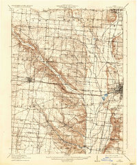
Editions of this 1914 St. Paris Map
2 editions found
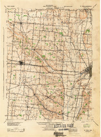
Historical Maps of Urbana Through Time
3 maps found
Featured Locations
Source Details
SourceU.S. Geological Survey
CopyrightPublic Domain