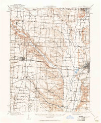
1914 Map of St. Paris
USGS Topo · Published 1961About this map
St Paris serves as the central hub of this pre-war survey, anchoring a dense network of steam and electric railways that defined west-central Ohio's early 20th-century economy. Major corridors like the Pittsburgh Cincinnati Chicago and St Louis RR and the Detroit Toledo and Ironton RR intersect here, while the Troy and Piqua Electric Road highlights the brief, significant era of interurban transit. The landscape is dotted with neighborhood identifiers, including numerous rural schoolhouses such as Speece School and Grafton School, and the notable County Infirmary near the Mad River. From the clustered settlements of Rosewood and Millerstown to the waters of Mosquito Lake, the map documents a transition from pioneer-era farmsteads to a modernizing transport-heavy corridor.
Find a feature on this map
95 named features on this map. Tap any name to fly to it.
Don’t see what you’re looking for? This feature index may not catch every label — zoom into the map to look around manually.
Map Details
Editions of this 1914 St. Paris Map
2 editions found
Other maps of this area

1904 · Springfield
USGS Topo · 1:62,500

1904 · Dayton
USGS Topo · 1:62,500

1906 · Dayton
USGS Topo · 1:62,500

1906 · Springfield
USGS Topo · 1:62,500

1907 · South Charleston
USGS Topo · 1:62,500

1913 · Bellefontaine
USGS Topo · 1:48,000

1913 · Sidney
USGS Topo · 1:62,500

1913 · East Liberty
USGS Topo · 1:62,500

1914 · Troy
USGS Topo · 1:62,500

1914 · St. Paris
USGS Topo · 1:62,500