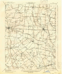
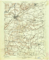
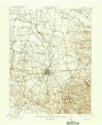
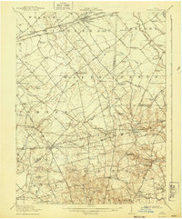
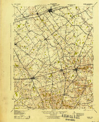
1916 Map of Octa
USGS Topo · Published 1941About this map
Jeffersonville and Octa serve as primary hubs within this agricultural landscape, where a dense network of early 20th-century rural schools highlights a deeply settled community structure. Dozens of small schoolhouses, such as Grassy Plain School, Hidy School, and Sugar Grove School, are spaced at regular intervals across the townships of Richland and Silver Creek. The regional economy is defined by its rail connectivity, notably the Detroit Toledo and Ironton RR and the Baltimore and Ohio Southwestern RR, which facilitated the movement of goods from smaller rail stops like Pearsons and Luttrell. The terrain is characterized by the winding paths of Rattlesnake Creek and Sugar Creek, with Dumpling Hill providing a rare named elevation. Genealogists will find particular value in the exact placement of old post offices like Selden PO and remote settlements such as Buchwalter and Grape Grove.
Find a feature on this map
107 named features on this map. Tap any name to fly to it.
Don’t see what you’re looking for? This feature index may not catch every label — zoom into the map to look around manually.
Map Details
Editions of this 1916 Octa Map
This is the sole edition of this map. No revisions or reprints were ever made.
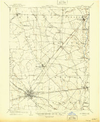
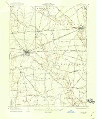
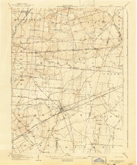
Other maps of this area

1904 · Springfield
USGS Topo · 1:62,500

1906 · Springfield
USGS Topo · 1:62,500
1906 · Mt Sterling
USGS Topo · 1:62,500

1907 · Blanchester
USGS Topo · 1:62,500
1907 · London
USGS Topo · 1:62,500
1907 · South Charleston
USGS Topo · 1:62,500
1917 · Xenia
USGS Topo · 1:62,500
1917 · Greenfield
USGS Topo · 1:62,500
1917 · Sabina
USGS Topo · 1:62,500
1943 · Sabina
USGS Topo · 1:62,500
Featured Places
- Sabina, Richland Township
- Jamestown, Silvercreek Township
- Jeffersonville, OH
- South Solon, Stokes Township
- Bowersville, Jefferson Township