
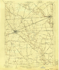
1907 Map of London
USGS Topo · Published 1940About this map
London serves as the central hub for this Madison County landscape, where several major transit lines converged at the start of the 20th century. The sheet documents an era defined by a dense web of electric interurban and steam railways, including the Columbus London and Springfield Electric RR and the Cleveland Cincinnati Chicago and St Louis RR. These lines bisect the townships of Union and Jefferson, connecting smaller settlements like Lafayette and West Jefferson to the regional economy.
Find a feature on this map
89 named features on this map. Tap any name to fly to it.
Don’t see what you’re looking for? This feature index may not catch every label — zoom into the map to look around manually.
Map Details
Editions of this 1907 London Map
2 editions found
Other maps of this area

1901 · Dublin
USGS Topo · 1:62,500

1903 · Dublin
USGS Topo · 1:62,500

1906 · Mt Sterling
USGS Topo · 1:62,500

1907 · South Charleston
USGS Topo · 1:62,500

1911 · Era
USGS Topo · 1:62,500

1913 · Era
USGS Topo · 1:62,500

1914 · Mechanicsburg
USGS Topo · 1:62,500

1916 · Mechanicsburg
USGS Topo · 1:62,500

1916 · Octa
USGS Topo · 1:62,500

1916 · Milford Center
USGS Topo · 1:62,500