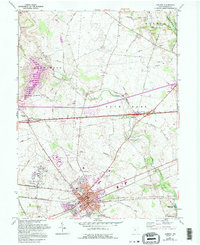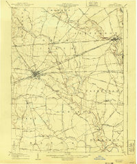
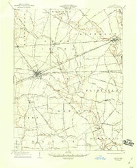
1907 Map of London
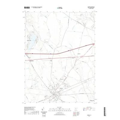
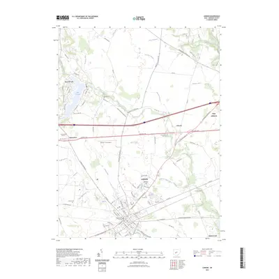
USGS Topo · Published 1940About this map
The town of London serves as the busy rail hub of central Madison County, where multiple major lines such as the Pittsburg Cincinnati Chicago and St Louis RR and the Columbus and London Electric RR converge. This industrial and transit network is superimposed on an agrarian landscape of pikes and runs, reflecting a period of intense connectivity before the dominance of modern highways. Outside the town limits, the terrain is defined by the winding course of Little Darby Creek and Deer Creek, which supported early industry like Andersons Mill. Local life is clearly visible through the placement of rural institutions, including the Childrens Home and scattered educational sites like Glade School and Dunn School. Further east, the village of Lilly Chapel sits at a crossroads of the Gregg Pike, anchoring a farming community that relied on these precise toll road alignments for transport and trade.
Find a feature on this map
90 named features on this map. Tap any name to fly to it.
Don’t see what you’re looking for? This feature index may not catch every label — zoom into the map to look around manually.
Map Details
Editions of this 1907 London Map
2 editions found
Historical Maps of London Through Time
7 maps found