1913 Map of Era
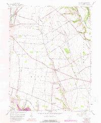
USGS Topo · Published 1936About this map
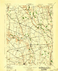
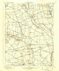
Darby Creek and Deer Creek dominate the landscape of Pickaway County in this early twentieth-century survey, revealing a rural economy built around water and rail. The village of Williamsport serves as a primary hub, situated near the Williamsport Sta and the B & O S W R R. Further south, the Pennsylvania System railroad cuts through Atlanta, while the western edge is defined by the London Road and Yankee Town Road. The map preserves the locations of numerous family-named schools and early river crossings such as Keppler Ford and Gulicks Ford. A notable industrial landmark, the Crownover Mill, sits along a sharp bend in Deer Creek. The township boundaries of Muhlenberg, Monroe, and Deer Creek help organize the scattered farmsteads and rural schoolhouses that once served this fertile agricultural region.
Find a feature on this map
108 named features on this map. Tap any name to fly to it.
Don’t see what you’re looking for? This feature index may not catch every label — zoom into the map to look around manually.
Map Details
Editions of this 1913 Era Map
This is the sole edition of this map. No revisions or reprints were ever made.
Historical Maps of South Bloomfield Through Time
9 maps found