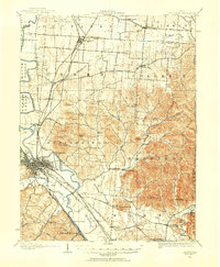
1908 Map of Chillicothe
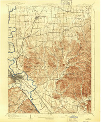
USGS Topo · Published 1943About this map
Chillicothe serves as the industrial and transportation nexus for this 1908-era survey of Ross and Pickaway counties. The city is a hub for several rail lines, including the Baltimore and Ohio Southwestern RR and the Norfolk and Western RR, while the nearby County Infirmary and numerous schools like Swamp School and Oakgrove School provide a look at the region’s early social infrastructure. To the east, the landscape transitions from the flat plains of the Scioto River valley into the prominent knobs and ridges of the Appalachian foothills.
Find a feature on this map
86 named features on this map. Tap any name to fly to it.
Don’t see what you’re looking for? This feature index may not catch every label — zoom into the map to look around manually.
Map Details
Editions of this 1908 Chillicothe Map
This is the sole edition of this map. No revisions or reprints were ever made.