
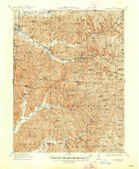
1912 Map of Laurelville
USGS Topo · Published 1939About this map
Indian Mound sits near the banks of Salt Creek, anchoring a landscape defined by the deep valleys and narrow ridges of the Hocking Hills region. Surveyed in 1910, this sheet documents the early 20th-century rural infrastructure of several intersecting counties, including the northern portions of Vinton and Ross. The area is dotted with family-named schools and churches like the Buchanan School and Mt. Carmel Church, reflecting a decentralized settlement pattern where small hill communities relied on local centers.
Find a feature on this map
87 named features on this map. Tap any name to fly to it.
Don’t see what you’re looking for? This feature index may not catch every label — zoom into the map to look around manually.
Map Details
Editions of this 1912 Laurelville Map
2 editions found
Other maps of this area

1904 · Zaleski
USGS Topo · 1:62,500

1905 · Wilkesville
USGS Topo · 1:62,500

1906 · Waverly
USGS Topo · 1:62,500

1906 · Chillicothe
USGS Topo · 1:62,500

1907 · Zaleski
USGS Topo · 1:62,500

1907 · Logan
USGS Topo · 1:62,500

1907 · Lancaster
USGS Topo · 1:62,500

1908 · Chillicothe
USGS Topo · 1:62,500

1908 · Wilkesville
USGS Topo · 1:62,500

1908 · Waverly
USGS Topo · 1:62,500