
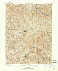
1904 Map of Zaleski
USGS Topo · Published 1955About this map
The Hocking River valley anchors the industrial and transport geography of this region during the early 20th century. Major rail lines, including the Hocking Valley R R and the Baltimore and Ohio Southwestern RR, trace the winding watercourses to service coal-rich townships like Brown and Madison. The map highlights a landscape defined by sharp elevation changes, particularly around The Pinnacle, and the intricate drainages of Raccoon Creek and Hewett Fork.
Find a feature on this map
57 named features on this map. Tap any name to fly to it.
Don’t see what you’re looking for? This feature index may not catch every label — zoom into the map to look around manually.
Map Details
Editions of this 1904 Zaleski Map
2 editions found
Other maps of this area

1903 · Athens
USGS Topo · 1:62,500

1905 · Athens
USGS Topo · 1:62,500

1905 · Wilkesville
USGS Topo · 1:62,500

1907 · Pomeroy
USGS Topo · 1:62,500

1907 · Zaleski
USGS Topo · 1:62,500

1907 · Logan
USGS Topo · 1:62,500

1907 · Lancaster
USGS Topo · 1:62,500

1908 · Wilkesville
USGS Topo · 1:62,500

1909 · Lancaster
USGS Topo · 1:62,500

1909 · Logan
USGS Topo · 1:62,500