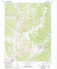
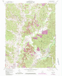
1961 Map of Zaleski
USGS Topo · Published 1995About this map
Raccoon Creek and its many winding tributaries like Brushy Fork and Twomile Run define this pocket of Vinton County, where public lands dominate the landscape. The transition between the Wayne National Forest and Zaleski State Forest creates a complex boundary system that encloses small settlements and historic landmarks. Significant local history is preserved in the numerous cemeteries dotting the ridges, including St Sylvester Cem and Oak Grove Cem, while the Indian Mound near Zaleski points to much earlier inhabitants. Settlement patterns follow the hollows and ridges, with Creola and Siverly serving as hubs along the rail lines and roads. Of particular interest to genealogists and local historians are the rural institutions such as the Swan Sch and the County Childrens Home, alongside numerous Oil Wells that indicate the area's industrial history.
Find a feature on this map
49 named features on this map. Tap any name to fly to it.
Don’t see what you’re looking for? This feature index may not catch every label — zoom into the map to look around manually.
Map Details
Editions of this 1961 Zaleski Map
5 editions found
Other maps of this area

1904 · Zaleski
USGS Topo · 1:62,500

1905 · Wilkesville
USGS Topo · 1:62,500

1907 · Zaleski
USGS Topo · 1:62,500

1908 · Wilkesville
USGS Topo · 1:62,500

1910 · Laurelville
USGS Topo · 1:62,500

1912 · Laurelville
USGS Topo · 1:62,500

1913 · Jackson
USGS Topo · 1:62,500

1944 · Jackson
USGS Topo · 1:62,500

1944 · Laurelville
USGS Topo · 1:62,500

1947 · Columbus
USGS Topo · 1:250,000