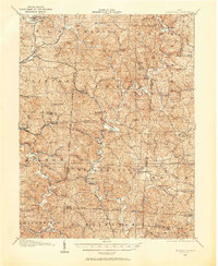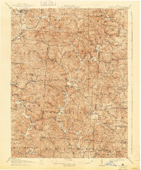
1908 Map of Wilkesville
USGS Topo · Published 1943About this map
The Vinton Furnace industrial site and nearby Hamden Furnace anchor this early twentieth-century survey of Vinton County, depicting an era when iron production and coal transport shaped the landscape. The intricate rail network of the Hocking Valley RR and the Baltimore and Ohio RR cuts through the hills, connecting small mining and milling settlements like Radcliff and Bolins Mills. The West Boundary of the Ohio Company Purchase is clearly delineated, marking a significant historical surveyor's line that influenced local land division. Rural life is densely recorded through a high concentration of country schools, including the Mound School and Chestnut Ridge School, and community centers such as Mt Olive Church. The meandering Raccoon Creek serves as the primary drainage for the townships of Wilkesville, Knox, and Madison, highlighting the relationship between the river-valley topography and the placement of early settlements.
Find a feature on this map
96 named features on this map. Tap any name to fly to it.
Don’t see what you’re looking for? This feature index may not catch every label — zoom into the map to look around manually.
Map Details
Editions of this 1908 Wilkesville Map
This is the sole edition of this map. No revisions or reprints were ever made.
Historical Maps of McArthur Through Time
8 maps found