
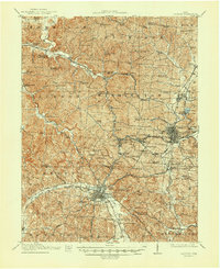
1913 Map of Jackson
USGS Topo · Published 1934About this map
Industrial nodes at Wellston and Jackson dominate this early 20th-century landscape, connected by a dense spiderweb of rail lines including the Baltimore and Ohio Southwestern RR and the Cincinnati Hamilton and Dayton RR. The region's heavy reliance on the extraction economy is evident in the presence of the Jackson Furnace and the clustered mining-associated settlements of Coalton, Glenroy, and Alteona.
Find a feature on this map
106 named features on this map. Tap any name to fly to it.
Don’t see what you’re looking for? This feature index may not catch every label — zoom into the map to look around manually.
Map Details
Editions of this 1913 Jackson Map
2 editions found
Other maps of this area

1904 · Zaleski
USGS Topo · 1:62,500

1905 · Wilkesville
USGS Topo · 1:62,500

1906 · Waverly
USGS Topo · 1:62,500

1906 · Bidwell
USGS Topo · 1:62,500

1906 · Chillicothe
USGS Topo · 1:62,500

1907 · Zaleski
USGS Topo · 1:62,500

1908 · Bidwell
USGS Topo · 1:62,500

1908 · Chillicothe
USGS Topo · 1:62,500

1908 · Wilkesville
USGS Topo · 1:62,500

1908 · Waverly
USGS Topo · 1:62,500