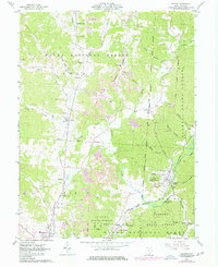
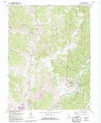
1961 Map of Zaleski
USGS Topo · Published 1977About this map
Raccoon Creek and its many tributaries, such as Brushy Fork, carve through the heavily forested landscape of Vinton County during the early 1960s. The village of Zaleski serves as a focal point, situated at the junction of the Baltimore and Ohio and Chesapeake and Ohio railroads. The topography is defined by prominent landforms like Bethel Ridge and Pumpkin Ridge, with the Wayne National Forest and Zaleski State Forest covering significant portions of the map.
Find a feature on this map
59 named features on this map. Tap any name to fly to it.
Don’t see what you’re looking for? This feature index may not catch every label — zoom into the map to look around manually.
Map Details
Editions of this 1961 Zaleski Map
5 editions found
Other maps of this area

1904 · Zaleski
USGS Topo · 1:62,500

1905 · Wilkesville
USGS Topo · 1:62,500

1907 · Zaleski
USGS Topo · 1:62,500

1908 · Wilkesville
USGS Topo · 1:62,500

1910 · Laurelville
USGS Topo · 1:62,500

1912 · Laurelville
USGS Topo · 1:62,500

1913 · Jackson
USGS Topo · 1:62,500

1944 · Jackson
USGS Topo · 1:62,500

1944 · Laurelville
USGS Topo · 1:62,500

1947 · Columbus
USGS Topo · 1:250,000