2022 Map of Center Point
USGS Topo · Published 2022About this map
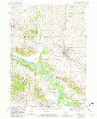
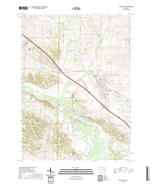
The Cedar River corridor dominates this portion of eastern Iowa, where the waterway creates a complex landscape of wetlands and lakes south of Center Point. The broad floodplain, containing features like Big Lewis Lake and the low-lying Lewis Bottoms area, contrasts with the organized grid of the surrounding uplands. Local history is anchored by several rural burial grounds, including McBroom Cem near the river and Davis Cem further north. Modern recreation and transportation follow historical patterns, notably with the Cedar Valley Nature Trl cutting a diagonal path through the terrain, tracing an old rail corridor. The settlement of Urbana sits at the northwestern edge, while smaller landmarks like Hannen Airport and multiple branches of Blue Cr highlight the transition between agriculture and suburban expansion in Linn and Benton Counties.
Find a feature on this map
98 named features on this map. Tap any name to fly to it.
Don’t see what you’re looking for? This feature index may not catch every label — zoom into the map to look around manually.
Map Details
Editions of this 2022 Center Point Map
This is the sole edition of this map. No revisions or reprints were ever made.