Old Maps of Benton County, Iowa
Explore 177 old maps of Benton County, spanning from 1888 to today. These high-resolution historic maps reveal how streets, neighborhoods, landmarks, and natural features evolved over time — perfect for genealogy, metal detecting, research, and local history exploration.
What you can do with these maps:
- See how Benton County changed over time: Compare historical maps to modern-day views to trace roads, homesites, rail lines & more.
- View detailed metadata: Each map includes creators, publishers, year, scale, and archive source.
- Overlay maps with satellite & LiDAR: Visualize the past alongside modern tools to explore terrain & human change.
- Trusted historical sources: Maps sourced from the USGS, Library of Congress, and other archives.
- Access maps your way: View online, download high-res files, or order prints for personal or research use.
Start exploring old maps of Benton County to uncover forgotten places, hidden landmarks, and the deep history beneath your feet.
Benton County, IA maps
(177)- 1888 Map of Shellsburg
 1888 Shellsburg1888 Print · USGSBenton and Linn Counties come alive in this late nineteenth-century survey of the eastern Iowa heartland. Local historians can trace the early rail-side growth of Shellsburg and Palo or follow the winding Cedar River past Opossum Creek and Urbana.
 - 1888 Map of Amana
 1888 Amana1888 Print · USGSThe Amana Colonies and the Iowa River valley are shown here in the late 1880s, during a period of communal prosperity and rail expansion. Genealogists can trace the specific villages of Hohe Amana, Middle Amana, and Homestead alongside three major railroads.
 - 1889 Map of Amana
 1889 Amana1889 Print · USGSCentral Iowa at the close of the nineteenth century reveals the unique communal settlement of the Amana colonies along the Iowa River. Trace early village footprints from Hohe Amana to Homestead and the rail corridors of the Chicago and Northwestern Railroad.2 unique versions available
 - 1889 Map of Shellsburg
 1889 Shellsburg1889 Print · USGSBenton and Linn Counties come alive in the late 1880s as the rail-driven economy begins to reshape the Iowa prairie. Researchers can trace the early development of Shellsburg and Center Point along the Burlington Cedar Rapids and Northern Railroad.
 - 1899 Map of Amana, 1910 Print
 1899 Amana1910 Print · USGSThe Amana Colonies and the surrounding prairies of Iowa and Benton counties appear here in the decades following their communal establishment. Genealogists and historians can trace the specific layouts of villages like Hohe Amana and Middle Amana or follow the early paths of the Chicago Rock Island and Pacific Railroad.
 - 1899 Map of Shellsburg, 1910 Print
 1899 Shellsburg1910 Print · USGSThe Cedar River valley in the late nineteenth century was a landscape of expanding rail lines and river-fronting townships. Trace the early footprints of Shellsburg, Center Point, and Palo along the route of the Burlington Cedar Rapids and Northern Railroad.
 - 1903 Map of Fairfax
 1903 Fairfax1903 Print · USGSEastern Iowa's rail-and-river corridor is captured here at the start of the twentieth century, showing the region's transition into an agricultural powerhouse. Genealogists can locate the seven original communal villages of the Amana colonies and old educational sites like Western College.2 unique versions available
 - 1903 Map of Winthrop
 1903 Winthrop1903 Print · USGSEast Central Iowa was a landscape of thriving rail towns and river crossings at the turn of the century. Genealogists and historians can trace the early footprints of Independence and Marion, or locate smaller centers like Quasqueton and Toddville.2 unique versions available
 - 1954 Map of Waterloo, 1968 Print
 1954 Waterloo1968 Print · USGSCentral Iowa at the height of its mid-century agricultural and rail boom features the growing hubs of Waterloo and Cedar Falls. Genealogists and researchers can trace the rail corridors of the Chicago Great Western and find local landmarks like Iowa State College and Brushy Ridge.4 unique versions available
 - 1954 Map of Des Moines, 1973 Print
 1954 Des Moines1973 Print · USGSCentral Iowa's evolving landscape is captured here in the early seventies, just as major reservoirs were reshaping the river valleys. Genealogists and historians can trace the rail corridors of the Burlington Northern or locate family roots near Pella, Indianola, and Knoxville.2 unique versions available
 - 1955 Map of Waterloo
 1955 Waterloo1955 Print · USGSCentral Iowa in the mid-fifties presents a dense landscape of rail-connected farming towns and growing river cities. Researchers can trace ancestral roots and old transport routes through Waterloo, Marshalltown, and Ames, while locating rural Cemeteries and local Quarries.2 unique versions available
 - 1956 Map of Des Moines
 1956 Des Moines1956 Print · USGSCentral Iowa in the mid-fifties shows a landscape defined by bustling rail hubs and deep-rooted agricultural research. Genealogists and researchers can trace the growth of Des Moines and Ames, locate the Sac and Fox Indian Reservation, or study the paths of the Skunk River and South Skunk River.
 - 1957 Map of Des Moines
 1957 Des Moines1957 Print · USGSCentral Iowa's post-war landscape is defined here by the converging rail lines and river valleys that shaped its earliest settlements. Genealogists and historians can trace the paths of the Rock Island Railroad and locate community landmarks in Des Moines, Ames, and Newton.
 - 1958 Map of Davenport, 1968 Print
 1958 Davenport1968 Print · USGSEastern Iowa and western Illinois thrive along the river during the late fifties, defined by the industrial Quad Cities and a robust rail network. Genealogists can trace family roots through settlements like Oasis and Stanwood or along the Cedar River.2 unique versions available
 - 1959 Map of Dubuque, 1982 Print
 1959 Dubuque1982 Print · USGSThe Tri-State region comes alive in the mid-twentieth century as a hub of river commerce and rail transit. Genealogists and historians can trace the paths of the Illinois Central Gulf through Dubuque or locate the Savanna Ordnance Depot and Lock and Dam No 11.
 - 1961 Map of Dubuque
 1961 Dubuque1961 Print · USGSThe Tri-State region's river-and-rail landscape is captured here during the early sixties, showing the convergence of Iowa, Illinois, and Wisconsin. Trace mid-century rail lines like the Chicago Great Western Ry and explore sites like the Savanna Ordnance Depot and Backbone State Park.
 - 1961 Map of Davenport
 1961 Davenport1961 Print · USGSThe Quad Cities and the eastern Iowa riverlands are captured here in the early sixties, showing the region's transition into a modern industrial and transit hub. Genealogists and historians can trace the paths of major railroads and find river landmarks like Rock Island Arsenal, Huron Island, and the Coralville Reservoir.
 - 1962 Map of Dubuque
 1962 Dubuque1962 Print · USGSThe Tri-State region's river-and-rail economy is captured here in the early sixties, centered on the Mississippi River bluffs. Genealogists and historians can locate Numerous lead and zinc mines, the New Melleray Abbey Monastery, and rural hubs like Saint Olaf.2 unique versions available
 - 1962 Map of Davenport
 1962 Davenport1962 Print · USGSThe Quad Cities and the Mississippi River corridor are shown at their industrial peak just before the interstate era fully transformed the region. Researchers can trace the sprawling rail networks of the Chicago Rock Island and Pacific and find landmarks like the Rock Island Arsenal and Wild Cat Den State Park.
 - 1963 Map of Eagle Center, 1964 Print
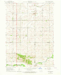 1963 Eagle Center1964 Print · USGSIn the early 1960s, this agricultural region at the junction of Black Hawk and Tama counties maintained a network of small community centers. Genealogists can trace family footprints through sites like Township Cem, Geneseo Ch, and St Mary Sch.2 unique versions available
 - 1965 Map of Ladora, 1966 Print
 1965 Ladora1966 Print · USGSIowa County is captured here in the mid-1960s, showing the agricultural heartland between the Iowa River and the local rail corridor. You can trace family history at Koszta Cem and Dayton Cem or locate the old Chicago Rock Island and Pacific line near Ladora.
 - 1965 Map of Keystone South, 1966 Print
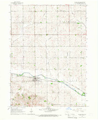
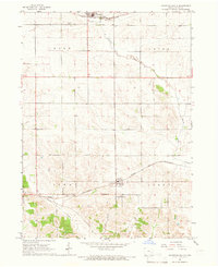 1965 Keystone South1966 Print · USGSBenton County agriculture and transit dominate the landscape in the mid-sixties, defined by the crossing of two major rail lines. Genealogists can trace family footprints through several burial sites like Holy Cross Cem, Lutheran Cem, and International Cem.
 - 1965 Map of Marengo, 1966 Print
 1965 Marengo1966 Print · USGSMarengo and the surrounding Iowa County townships are captured in the mid-1960s as a thriving rail and river hub. Genealogists can locate family sites at Titus Cem, St Martins Ch, and Iowa Valley Sch along the river valley.
 - 1965 Map of Blairstown, 1966 Print
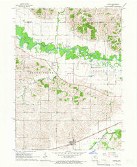
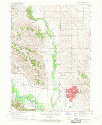
 1965 Blairstown1966 Print · USGSBenton County agriculture and rail transit are captured here in the mid-1960s, centered on the hub of Blairstown. Researchers can trace the path of the Chicago and North Western railroad or locate family burial sites at Pleasant Hill Cem and Calvary Cem.
 - 1968 Map of Belle Plaine, 1970 Print
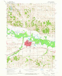
 1968 Belle Plaine1970 Print · USGSBenton and Tama counties appear here in the late sixties, centered on the rail hub of Belle Plaine and the Iowa River. Genealogists can locate several local burial sites including St Marys Cem, Irving Cem, and National Cem.2 unique versions available
Showing maps 1-25 of 177
Top cities of Benton County
- Vinton historical maps
- Belle Plaine historical maps
- Atkins historical maps
- Urbana historical maps
- Shellsburg historical maps
- Newhall historical maps
See more
Frequently asked questions
- What are the different types of historical maps available for Benton County?
- What is the oldest map of Benton County?
- Where can I purchase historical maps of Benton County for my home or office?
- Where can I download high-res historical maps of Benton County?
- Are there historical topographic maps available for Benton County?
- Is there historical aerial imagery available for Benton County?
- Where are historical maps of Benton County sourced from?